
Magnitude |
:3.3 |
| Date & Time (UTC) | 2011-10-22 19:47:08.2 |
| Date & Time (Local) | 1390/7/30 23:17:08.2 |
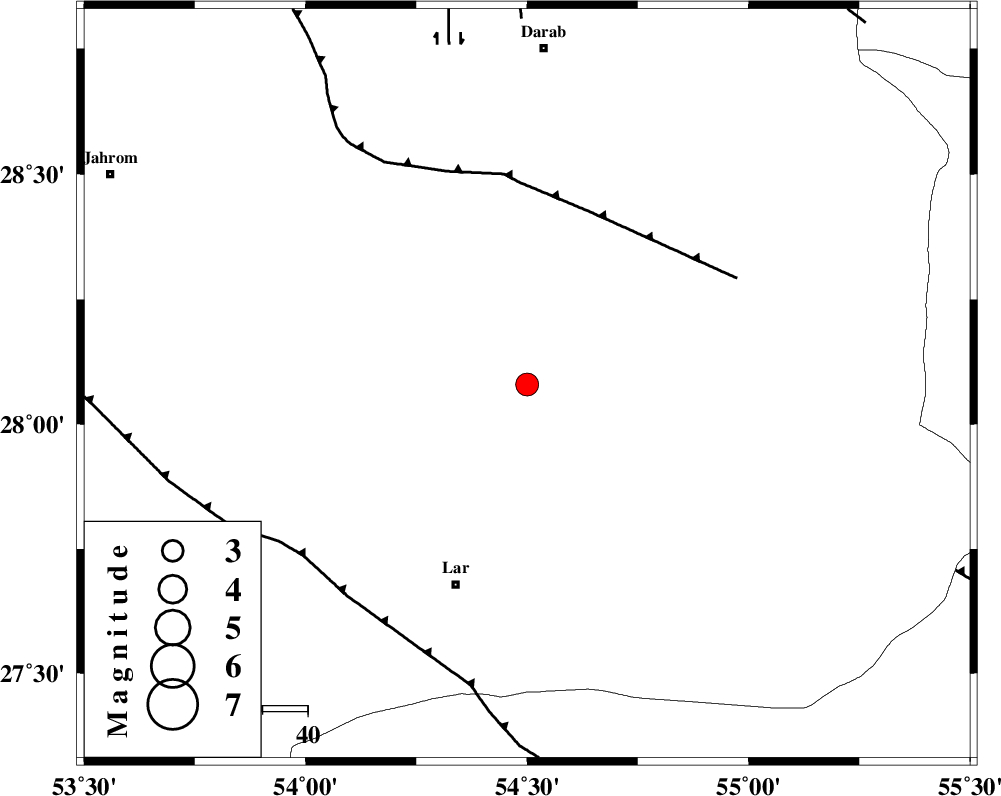
| Location | Lat:28.08 Lon: 54.5 |
| Region | Fars Province, 48 km North-East of Lar |
Nearest Cities |
|
| 26 km North of Dehkuyeh, Fars Province | |
| 30 km South East of Shahr-e pir, Fars Province | |
| 32 km South of Hajiabad, Fars Province | |
| 44 km North East of Latifi, Fars Province | |
| 47 km South East of Dabiran, Fars Province | |
| Depth | 14 km |
| Agency | |
Faults within 150 km: |
|
| BERIZ_F (Length: 49 km) , Distance to epicenter: 36 km | |
| HZF2 (Length: 437 km) , Distance to epicenter: 40 km | |
| LAR_F (Length: 99 km) , Distance to epicenter: 57 km | |
| Number of Phases | 4 |
| RMS | 0.2 |
| Number of Stations | 3 |
| Error in Latitude | >6.5 km |
| Error in Longitude | 4.2 km |
| Error in Depth | 9.3 km |
Download waveform in seisan format
to download seisan software Click here
to access information about IIEES stations Click here
Amplitude | ||||||||
| UID | Agency | Station | Component | Amplitude | Period | Arrival Time | Proccessing Time | Signal Clip |
| 80510 | IIEES | GHIR | E | 583 | 0.79 | 2011-10-22 19:48:06 | 2011-10-22 08:18:00 | n |
| 80511 | IIEES | KRBR | N | 98.7 | 0.49 | 2011-10-22 19:48:35 | 2011-10-22 08:18:00 | n |
| 80512 | IIEES | KRBR | E | 112.4 | 0.25 | 2011-10-22 19:48:44 | 2011-10-22 08:18:00 | n |
Phase | ||||||||||||
| Agency | Station | Component | Phase Type | Phase Quality | First Motion | Observed Arrival Time | Time Residual | Loc. Flag | Input Weight | Distance | Azimuth | |
| IIEES | GHIR | Z | Pg | E | 2011-10-22 19:47:33 | -0.07 | y | 150 | 279 | |||
| IIEES | KRBR | Z | Pn | E | 2011-10-22 19:47:54 | 0.31 | y | 305 | 46 | |||
| IIEES | KRBR | N | Sg | E | 2011-10-22 19:48:33 | -0.15 | y | 305 | 46 | |||
| IIEES | CHBR | Z | Pn | E | 2011-10-22 19:48:36 | -0.16 | y | 655 | 114 | |||