
Magnitude |
:2.7 |
| Date & Time (UTC) | 2011-10-22 17:47:07.8 |
| Date & Time (Local) | 1390/7/30 21:17:07.8 |
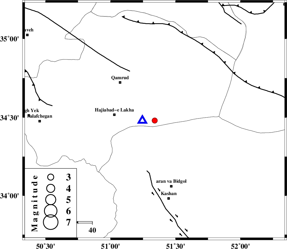
| Location | Lat:34.48 Lon: 51.34 |
| Region | Qom Province, 48 km North-West of Aran va bidgol |
Nearest Cities |
|
| 29 km East of Hajiabad-e lakha, Qom Province | |
| 35 km North of Mashgan, Esfahan Province | |
| 36 km South East of Qamrud, Qom Province | |
| 39 km North of Nasrabad, Esfahan Province | |
| 40 km North East of Yahyaabad, Esfahan Province | |
| Depth | 6 km |
| Agency | |
Faults within 150 km: |
|
| KASHAN_F (Length: 44 km) , Distance to epicenter: 36 km | |
| KUSHK_E_NOSRAT_F (Length: 230 km) , Distance to epicenter: 39 km | |
| SIAHKUH_F (Length: 154 km) , Distance to epicenter: 63 km | |
| Number of Phases | 6 |
| RMS | 0.1 |
| Number of Stations | 5 |
| Error in Latitude | >1.8 km |
| Error in Longitude | 1.7 km |
| Error in Depth | 5.4 km |
Download waveform in seisan format
to download seisan software Click here
to access information about IIEES stations Click here
Amplitude | ||||||||
| UID | Agency | Station | Component | Amplitude | Period | Arrival Time | Proccessing Time | Signal Clip |
| 80506 | IIEES | GHVR | N | 8496.3 | 0.19 | 2011-10-22 17:47:10 | 2011-10-22 06:23:00 | n |
| 80507 | IIEES | GHVR | E | 10285.4 | 0.16 | 2011-10-22 17:47:10 | 2011-10-22 06:23:00 | n |
| 80508 | IIEES | CHTH | E | 41.3 | 0.68 | 2011-10-22 17:47:59 | 2011-10-22 06:23:00 | n |
| 80509 | IIEES | NASN | E | 34.7 | 0.89 | 2011-10-22 17:48:17 | 2011-10-22 06:23:00 | n |
Phase | ||||||||||||
| Agency | Station | Component | Phase Type | Phase Quality | First Motion | Observed Arrival Time | Time Residual | Loc. Flag | Input Weight | Distance | Azimuth | |
| IIEES | GHVR | Z | Pg | E | 2011-10-22 17:47:09 | 0 | y | 9.01 | 272 | |||
| IIEES | ASAO | Z | Pg | E | 2011-10-22 17:47:29 | 0.26 | y | 121 | 274 | |||
| IIEES | ASAO | N | Sg | E | 2011-10-22 17:47:44 | -0.08 | y | 121 | 274 | |||
| IIEES | KHMZ | Z | Pg | E | 2011-10-22 17:47:33 | -0.13 | y | 151 | 238 | |||
| IIEES | CHTH | Z | Pg | E | 2011-10-22 17:47:35 | -0.07 | y | 160 | 353 | |||
| IIEES | NASN | Z | Pg | E | 2011-10-22 17:47:47 | 0.01 | y | 230 | 143 | |||