
Magnitude |
:3.7 |
| Date & Time (UTC) | 2011-10-17 00:02:44.6 |
| Date & Time (Local) | 1390/7/25 03:32:44.6 |
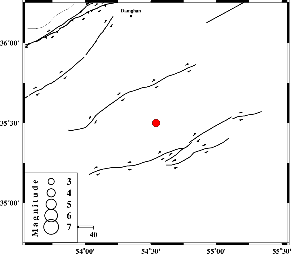
| Location | Lat:35.5 Lon: 54.54 |
| Region | Semnan Province, 75 km South-East of Damghan |
Nearest Cities |
|
| 68 km South East of Amirabad, Semnan Province | |
| 71 km South East of Seydabad, Semnan Province | |
| 76 km South East of Damghan, Semnan Province | |
| 79 km South East of Darvar, Semnan Province | |
| 80 km South of Mehmandust, Semnan Province | |
| Depth | 18 km |
| Agency | |
Faults within 150 km: |
|
| TORUD_F (Length: 136 km) , Distance to epicenter: 22 km | |
| ATARI_F (Length: 185 km) , Distance to epicenter: 76 km | |
| MEYAMEY_F (Length: 141 km) , Distance to epicenter: 78 km | |
| Number of Phases | 7 |
| RMS | 0.1 |
| Number of Stations | 6 |
| Error in Latitude | >2.5 km |
| Error in Longitude | 3 km |
| Error in Depth | 6.4 km |
Download waveform in seisan format
to download seisan software Click here
to access information about IIEES stations Click here
Amplitude | ||||||||
| UID | Agency | Station | Component | Amplitude | Period | Arrival Time | Proccessing Time | Signal Clip |
| 80456 | IIEES | GHVR | N | 197.9 | 0.48 | 2011-10-17 00:04:22 | 2011-10-17 12:27:00 | n |
| 80457 | IIEES | GHVR | E | 181.9 | 0.64 | 2011-10-17 00:04:27 | 2011-10-17 12:27:00 | n |
| 80458 | IIEES | THKV | E | 264.7 | 0.6 | 2011-10-17 00:04:22 | 2011-10-17 12:27:00 | n |
| 80459 | IIEES | THKV | N | 330.8 | 0.52 | 2011-10-17 00:04:25 | 2011-10-17 12:27:00 | n |
Phase | ||||||||||||
| Agency | Station | Component | Phase Type | Phase Quality | First Motion | Observed Arrival Time | Time Residual | Loc. Flag | Input Weight | Distance | Azimuth | |
| IIEES | SHRO | Z | Pg | E | 2011-10-17 00:03:08 | -0.07 | y | 145 | 67 | |||
| IIEES | CHTH | Z | Pn | E | 2011-10-17 00:03:30 | 0.13 | y | 312 | 279 | |||
| IIEES | TABS | Z | Pn | E | 2011-10-17 00:03:30 | -0.05 | y | 314 | 130 | |||
| IIEES | TABS | N | Sg | E | 2011-10-17 00:04:12 | 0.09 | y | 314 | 130 | |||
| IIEES | GHVR | Z | Pn | E | 2011-10-17 00:03:31 | -0.12 | y | 321 | 250 | |||
| IIEES | THKV | Z | Pn | E | 2011-10-17 00:03:33 | 0.15 | y | 334 | 279 | |||
| IIEES | KHMZ | Z | Pn | E | 2011-10-17 00:03:49 | -0.16 | y | 463 | 246 | |||