
Magnitude |
:3.1 |
| Date & Time (UTC) | 2011-10-08 04:10:04.3 |
| Date & Time (Local) | 1390/7/16 07:40:04.3 |
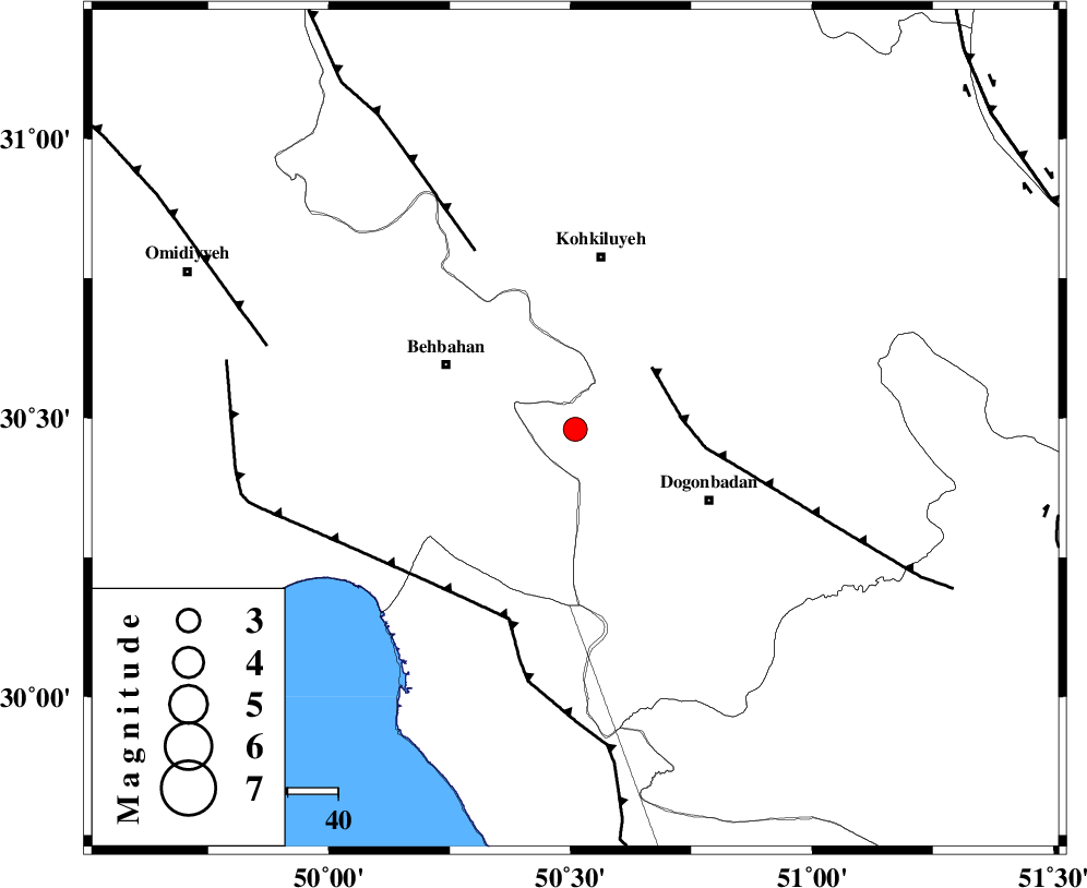
| Location | Lat:30.48 Lon: 50.51 |
| Region | Kohkiluieh va boyerahmad Province, 35 km South of Dehdasht |
Nearest Cities |
|
| 26 km South East of Mansuriyeh, Khoozestan Province | |
| 29 km South East of Behbahan, Khoozestan Province | |
| 30 km North West of Dogonbadan, Kohkiluieh va boyerahmad Province | |
| 33 km North East of Sardasht, Khoozestan Province | |
| 35 km South of Dehdasht, Kohkiluieh va boyerahmad Province | |
| Depth | 14 km |
| Agency | |
Faults within 150 km: |
|
| MISHAN_F (Length: 76 km) , Distance to epicenter: 20 km | |
| ZFF3 (Length: 125 km) , Distance to epicenter: 40 km | |
| RAG_E_SEFID_F (Length: 84 km) , Distance to epicenter: 40 km | |
| Number of Phases | 7 |
| RMS | 0.1 |
| Number of Stations | 6 |
| Error in Latitude | >1.8 km |
| Error in Longitude | 3.3 km |
| Error in Depth | 4 km |
Download waveform in seisan format
to download seisan software Click here
to access information about IIEES stations Click here
Amplitude | ||||||||
| UID | Agency | Station | Component | Amplitude | Period | Arrival Time | Proccessing Time | Signal Clip |
| 80415 | IIEES | AHRM | E | 176.4 | 0.44 | 2011-10-08 04:11:04 | 2011-10-08 04:33:00 | n |
| 80416 | IIEES | AHRM | N | 194.1 | 0.6 | 2011-10-08 04:11:08 | 2011-10-08 04:33:00 | n |
| 80417 | IIEES | GHIR | E | 49.3 | 0.36 | 2011-10-08 04:11:33 | 2011-10-08 04:33:00 | n |
Phase | ||||||||||||
| Agency | Station | Component | Phase Type | Phase Quality | First Motion | Observed Arrival Time | Time Residual | Loc. Flag | Input Weight | Distance | Azimuth | |
| IIEES | AHRM | Z | Pn | E | 2011-10-08 04:10:35 | -0.13 | y | 195 | 157 | |||
| IIEES | AHRM | E | Sg | E | 2011-10-08 04:10:59 | 0.05 | y | 195 | 157 | |||
| IIEES | SHGR | Z | Pn | E | 2011-10-08 04:10:42 | 0.16 | y | 243 | 318 | |||
| IIEES | SHGR | E | Sg | E | 2011-10-08 04:11:12 | -0.1 | y | 243 | 318 | |||
| IIEES | NASN | Z | Pn | E | 2011-10-08 04:10:54 | -0.06 | y | 337 | 40 | |||
| IIEES | KHMZ | E | Pn | E | 2011-10-08 04:10:57 | 0.02 | y | 365 | 352 | |||
| IIEES | ASAO | N | Pn | E | 2011-10-08 04:11:08 | 0.08 | y | 453 | 354 | |||