
Magnitude |
:2.9 |
| Date & Time (UTC) | 2011-10-03 04:53:20.0 |
| Date & Time (Local) | 1390/7/11 08:23:20.0 |
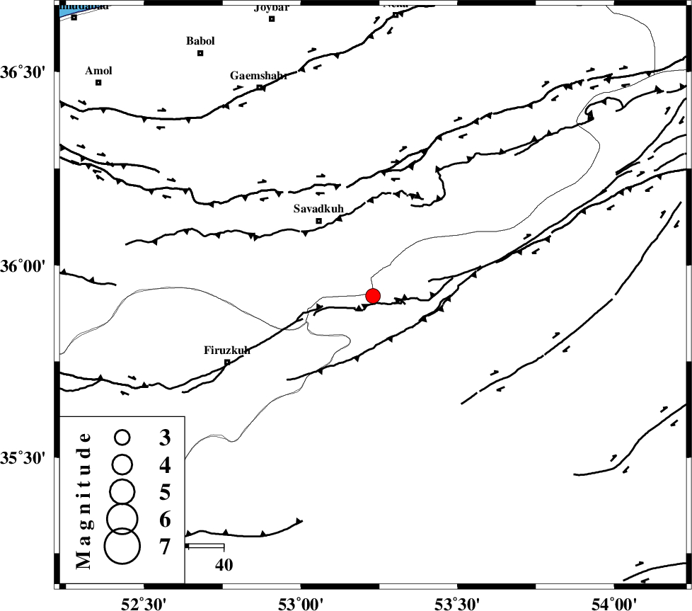
| Location | Lat:35.92 Lon: 53.23 |
| Region | Semnan Province, 26 km South-East of Pol-E-Sefid |
Nearest Cities |
|
| 4 km North of Chashem, Semnan Province | |
| 16 km South of Sangdeh, Mazandaran Province | |
| 19 km North of Shahmirzad, Semnan Province | |
| 25 km South East of Shurmast-e peyrudbar, Mazandaran Province | |
| 26 km North West of Mehdishahr, Semnan Province | |
| Depth | 14 km |
| Agency | |
Faults within 150 km: |
|
| ATARI_F (Length: 185 km) , Distance to epicenter: 28 km | |
| N_ALBORZ_F (Length: 360 km) , Distance to epicenter: 32 km | |
| MOSHA_F (Length: 234 km) , Distance to epicenter: 59 km | |
| Number of Phases | 7 |
| RMS | 0.2 |
| Number of Stations | 7 |
| Error in Latitude | >3.6 km |
| Error in Longitude | 3.7 km |
| Error in Depth | 7 km |
Download waveform in seisan format
to download seisan software Click here
to access information about IIEES stations Click here
Amplitude | ||||||||
| UID | Agency | Station | Component | Amplitude | Period | Arrival Time | Proccessing Time | Signal Clip |
| 80352 | IIEES | GHVR | E | 78.2 | 0.35 | 2011-10-03 04:54:35 | 2011-10-03 05:22:00 | n |
| 80353 | IIEES | GHVR | N | 86.5 | 0.49 | 2011-10-03 04:54:36 | 2011-10-03 05:22:00 | n |
Phase | ||||||||||||
| Agency | Station | Component | Phase Type | Phase Quality | First Motion | Observed Arrival Time | Time Residual | Loc. Flag | Input Weight | Distance | Azimuth | |
| IIEES | CHTH | Z | Pg | E | 2011-10-03 04:53:51 | -0.17 | y | 190 | 270 | |||
| IIEES | GHVR | Z | Pg | E | 2011-10-03 04:53:59 | -0.02 | y | 241 | 229 | |||
| IIEES | SHRO | Z | Pn | E | 2011-10-03 04:53:58 | -0.19 | y | 252 | 87 | |||
| IIEES | MRVT | Z | Pn | E | 2011-10-03 04:54:07 | 0.27 | y | 320 | 52 | |||
| IIEES | ASAO | Z | Pn | E | 2011-10-03 04:54:08 | 0.11 | y | 329 | 243 | |||
| IIEES | NASN | Z | Pn | E | 2011-10-03 04:54:11 | 0.24 | y | 348 | 186 | |||
| IIEES | TABS | Z | Pn | E | 2011-10-03 04:54:21 | -0.22 | y | 436 | 124 | |||