
Magnitude |
:2.9 |
| Date & Time (UTC) | 2011-10-02 02:06:45.5 |
| Date & Time (Local) | 1390/7/10 05:36:45.5 |
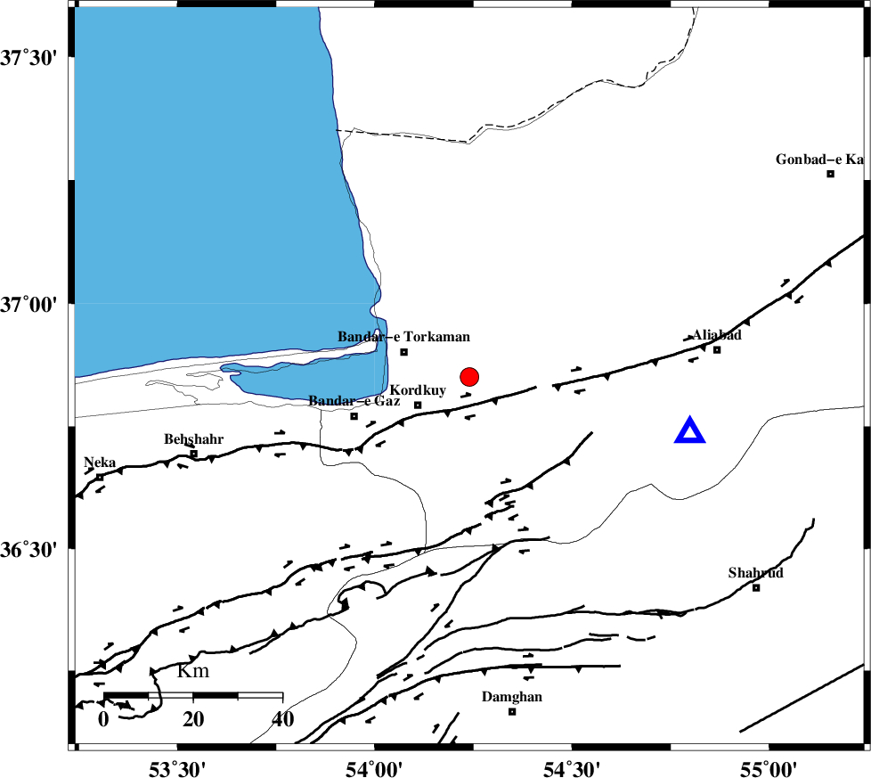
| Location | Lat:36.85 Lon: 54.24 |
| Region | Golestan Province, 13 km East of Kordkuy |
Nearest Cities |
|
| 8 km North of Lamsak, Golestan Province | |
| 12 km East of Sijval, Golestan Province | |
| 13 km North East of Kordkuy, Golestan Province | |
| 16 km East of Bandar-e torkaman, Golestan Province | |
| 18 km North West of Gorgan, Golestan Province | |
| Depth | 15 km |
| Agency | |
Faults within 150 km: |
|
| KHAZAR_F (Length: 523 km) , Distance to epicenter: 9 km | |
| N_ALBORZ_F (Length: 360 km) , Distance to epicenter: 30 km | |
| SHAVAR_F (Length: 87 km) , Distance to epicenter: 35 km | |
| Number of Phases | 4 |
| RMS | 0 |
| Number of Stations | 5 |
| Error in Latitude | >3 km |
| Error in Longitude | 2.9 km |
| Error in Depth | 4.7 km |
Download waveform in seisan format
to download seisan software Click here
to access information about IIEES stations Click here
Amplitude | ||||||||
| UID | Agency | Station | Component | Amplitude | Period | Arrival Time | Proccessing Time | Signal Clip |
| 80349 | IIEES | MRVT | N | 126.7 | 0.27 | 2011-10-02 02:07:45 | 2011-10-02 02:29:00 | n |
| 80350 | IIEES | MRVT | E | 168.3 | 0.94 | 2011-10-02 02:07:45 | 2011-10-02 02:29:00 | n |
| 80351 | IIEES | GRMI | E | 5.1 | 0.47 | 2011-10-02 02:09:13 | 2011-10-02 02:29:00 | n |
Phase | ||||||||||||
| Agency | Station | Component | Phase Type | Phase Quality | First Motion | Observed Arrival Time | Time Residual | Loc. Flag | Input Weight | Distance | Azimuth | |
| IIEES | SHRO | Z | Pg | E | 2011-10-02 02:07:15 | 0.01 | y | 184 | 120 | |||
| IIEES | MRVT | Z | Pg | E | 2011-10-02 02:07:16 | 0 | y | 187 | 61 | |||
| IIEES | BJRD | Z | Pn | E | 2011-10-02 02:07:29 | -0.01 | y | 296 | 70 | |||
| IIEES | CHTH | Z | Pn | E | 2011-10-02 02:07:30 | 0 | y | 298 | 250 | |||