
Magnitude |
:3.4 |
| Date & Time (UTC) | 2011-09-18 03:03:04.8 |
| Date & Time (Local) | 1390/6/27 07:33:04.8 |
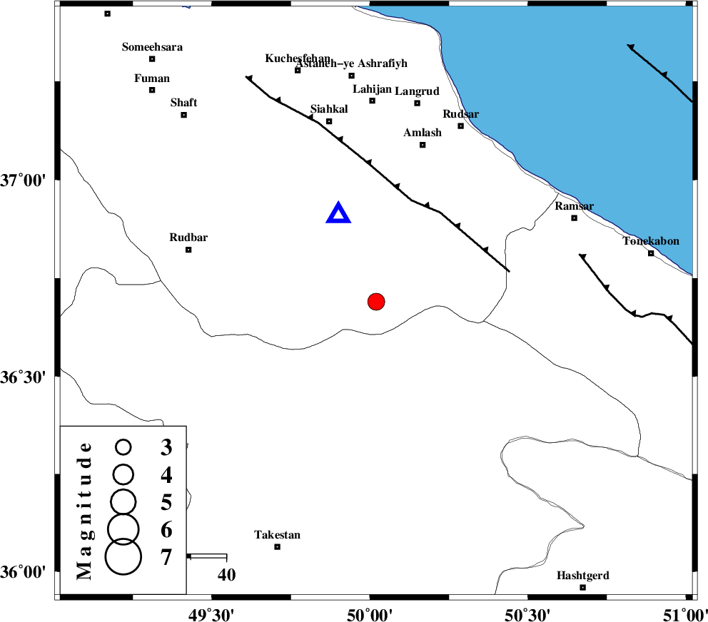
| Location | Lat:36.69 Lon: 50.02 |
| Region | Gilan Province, 48 km North of Qazvin |
Nearest Cities |
|
| 5 km of Kelishom, Gilan Province | |
| 21 km East of Jirhandeh, Gilan Province | |
| 22 km South East of Barresar, Gilan Province | |
| 30 km South West of Ziar, Gilan Province | |
| 36 km North West of Tamol, Mazandaran Province | |
| Depth | 14 km |
| Agency | |
Faults within 150 km: |
|
| RUDBAR_F (Length: 93 km) , Distance to epicenter: 12 km | |
| BONAN_F (Length: 74 km) , Distance to epicenter: 14 km | |
| ALAMUTRUD_F (Length: 140 km) , Distance to epicenter: 14 km | |
| Number of Phases | 5 |
| RMS | 0.3 |
| Number of Stations | 5 |
| Error in Latitude | >9.3 km |
| Error in Longitude | 5.9 km |
| Error in Depth | 8.7 km |
Download waveform in seisan format
to download seisan software Click here
to access information about IIEES stations Click here
Amplitude | ||||||||
| UID | Agency | Station | Component | Amplitude | Period | Arrival Time | Proccessing Time | Signal Clip |
| 80256 | IIEES | ZNJK | N | 727 | 0.21 | 2011-09-18 03:03:42 | 2011-09-18 03:17:00 | n |
| 80257 | IIEES | ASAO | E | 206.4 | 0.5 | 2011-09-18 03:04:21 | 2011-09-18 03:17:00 | n |
| 80258 | IIEES | GHVR | N | 245.8 | 0.85 | 2011-09-18 03:04:29 | 2011-09-18 03:17:00 | n |
| 80259 | IIEES | GHVR | E | 151.9 | 0.85 | 2011-09-18 03:04:39 | 2011-09-18 03:17:00 | n |
Phase | ||||||||||||
| Agency | Station | Component | Phase Type | Phase Quality | First Motion | Observed Arrival Time | Time Residual | Loc. Flag | Input Weight | Distance | Azimuth | |
| IIEES | THKV | Z | Pg | E | 2011-09-18 03:03:24 | 0.44 | y | 116 | 138 | |||
| IIEES | ZNJK | Z | Pg | E | 2011-09-18 03:03:24 | 0.01 | y | 119 | 269 | |||
| IIEES | CHTH | Z | Pg | E | 2011-09-18 03:03:26 | -0.42 | y | 132 | 131 | |||
| IIEES | ASAO | Z | Pg | E | 2011-09-18 03:03:43 | -0.12 | y | 238 | 180 | |||
| IIEES | GHVR | Z | Pn | E | 2011-09-18 03:03:46 | 0.09 | y | 270 | 155 | |||