
Magnitude |
:2.8 |
| Date & Time (UTC) | 2011-09-07 09:34:46.2 |
| Date & Time (Local) | 1390/6/16 14:04:46.2 |
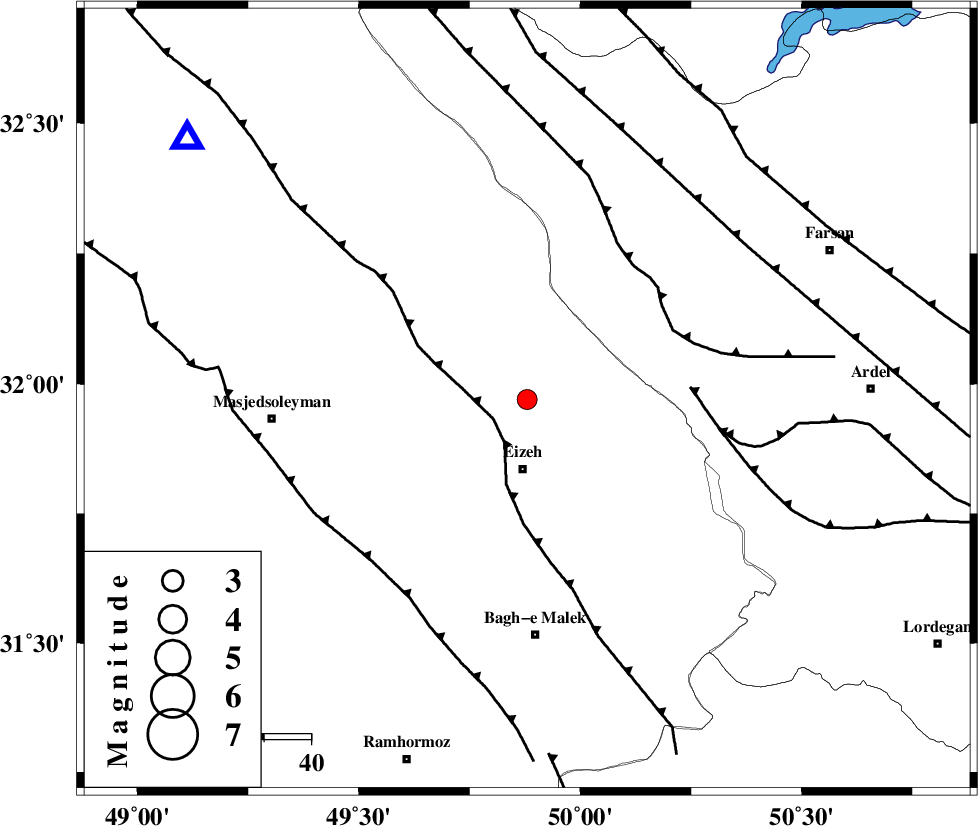
| Location | Lat:31.97 Lon: 49.88 |
| Region | Khoozestan Province, 15 km North of Izeh |
Nearest Cities |
|
| 6 km of Torshak, Khoozestan Province | |
| 13 km North of Rasvand, Khoozestan Province | |
| 15 km North of Izeh, Khoozestan Province | |
| 22 km North of Chenarestan, Khoozestan Province | |
| 38 km North of Ghaleh tal, Khoozestan Province | |
| Depth | 32 km |
| Agency | |
Faults within 150 km: |
|
| MFF2 (Length: 205 km) , Distance to epicenter: 8 km | |
| ZARDKUH_F (Length: 139 km) , Distance to epicenter: 34 km | |
| DOPOLAN_F (Length: 107 km) , Distance to epicenter: 35 km | |
| Number of Phases | 7 |
| RMS | 0.4 |
| Number of Stations | 7 |
| Error in Latitude | >8.5 km |
| Error in Longitude | 7.1 km |
| Error in Depth | 9 km |
Download waveform in seisan format
to download seisan software Click here
to access information about IIEES stations Click here
Amplitude | ||||||||
| UID | Agency | Station | Component | Amplitude | Period | Arrival Time | Proccessing Time | Signal Clip |
| 80193 | IIEES | SHGR | E | 606.9 | 0.5 | 2011-09-07 09:35:23 | 2011-09-07 10:01:00 | n |
| 80194 | IIEES | KHMZ | E | 79.9 | 0.37 | 2011-09-07 09:35:49 | 2011-09-07 10:01:00 | n |
| 80195 | IIEES | ASAO | E | 29.6 | 0.57 | 2011-09-07 09:36:15 | 2011-09-07 10:01:00 | n |
| 80196 | IIEES | ASAO | N | 30.6 | 0.67 | 2011-09-07 09:36:18 | 2011-09-07 10:01:00 | n |
Phase | ||||||||||||
| Agency | Station | Component | Phase Type | Phase Quality | First Motion | Observed Arrival Time | Time Residual | Loc. Flag | Input Weight | Distance | Azimuth | |
| IIEES | SHGR | Z | Pg | E | 2011-09-07 09:35:03 | 0.18 | y | 103 | 279 | |||
| IIEES | KHMZ | Z | Pg | E | 2011-09-07 09:35:17 | -0.21 | y | 197 | 2 | |||
| IIEES | ASAO | Z | Pn | E | 2011-09-07 09:35:28 | 0.44 | y | 286 | 3 | |||
| IIEES | NASN | Z | Pn | E | 2011-09-07 09:35:28 | -0.24 | y | 290 | 71 | |||
| IIEES | GHVR | Z | P | E | 2011-09-07 09:35:30 | 0.49 | y | 306 | 24 | |||
| IIEES | SNGE | Z | Pn | E | 2011-09-07 09:35:43 | -0.64 | y | 419 | 326 | |||
| IIEES | CHTH | Z | Pn | E | 2011-09-07 09:35:48 | -0.15 | y | 452 | 14 | |||