
Magnitude |
:3.3 |
| Date & Time (UTC) | 2011-08-30 16:12:42.5 |
| Date & Time (Local) | 1390/6/8 20:42:42.5 |
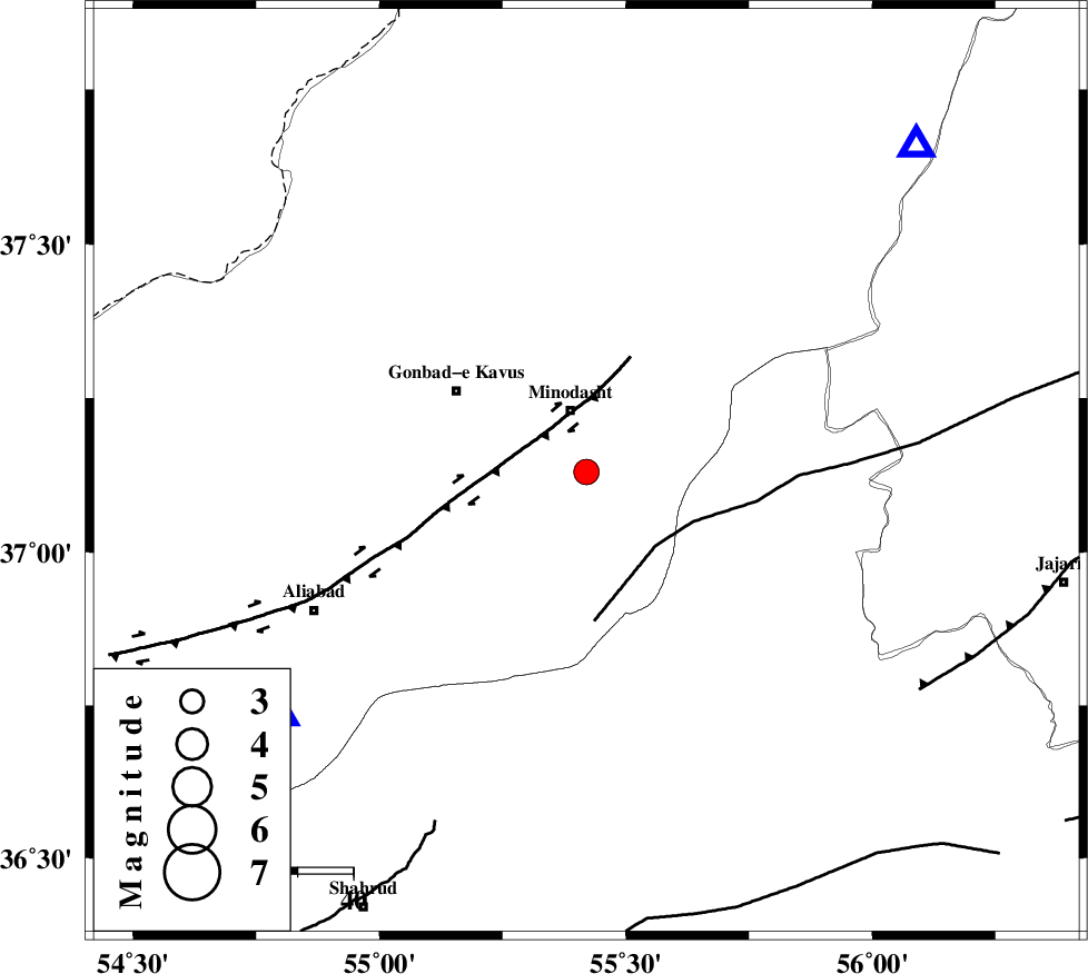
| Location | Lat:37.13 Lon: 55.42 |
| Region | Golestan Province, 12 km South of Minodasht |
Nearest Cities |
|
| 11 km of Minodasht, Golestan Province | |
| 12 km North of Qale-ye qafeh, Golestan Province | |
| 14 km North West of Duzin, Golestan Province | |
| 16 km South of Galikesh, Golestan Province | |
| 20 km South of Yanqaq, Golestan Province | |
| Depth | 15 km |
| Agency | |
Faults within 150 km: |
|
| ROBATE_QARABIL_F (Length: 168 km) , Distance to epicenter: 18 km | |
| KHAZAR_F (Length: 523 km) , Distance to epicenter: 43 km | |
| SHAVAR_F (Length: 87 km) , Distance to epicenter: 44 km | |
| Number of Phases | 3 |
| RMS | 0 |
| Number of Stations | 4 |
| Error in Latitude | >2.6 km |
| Error in Longitude | 10 km |
| Error in Depth | 0 km |
Download waveform in seisan format
to download seisan software Click here
to access information about IIEES stations Click here
Amplitude | ||||||||
| UID | Agency | Station | Component | Amplitude | Period | Arrival Time | Proccessing Time | Signal Clip |
| 80120 | IIEES | BJRD | N | 437 | 0.95 | 2011-08-30 16:13:37 | 2011-08-30 04:34:00 | n |
| 80121 | IIEES | GRMI | N | 8.8 | 0.35 | 2011-08-30 16:15:26 | 2011-08-30 04:34:00 | n |
| 80122 | IIEES | GRMI | E | 6.4 | 0.35 | 2011-08-30 16:15:29 | 2011-08-30 04:34:00 | n |
Phase | ||||||||||||
| Agency | Station | Component | Phase Type | Phase Quality | First Motion | Observed Arrival Time | Time Residual | Loc. Flag | Input Weight | Distance | Azimuth | |
| IIEES | MRVT | Z | P | E | 2011-08-30 16:12:56 | 0 | y | 83.3 | 45 | |||
| IIEES | SHRO | Z | Pg | E | 2011-08-30 16:13:05 | 0 | y | 135 | 157 | |||
| IIEES | BJRD | Z | Pg | E | 2011-08-30 16:13:13 | 0 | y | 187 | 70 | |||