
Magnitude |
:2.9 |
| Date & Time (UTC) | 2011-08-18 11:17:09.6 |
| Date & Time (Local) | 1390/5/27 15:47:09.6 |
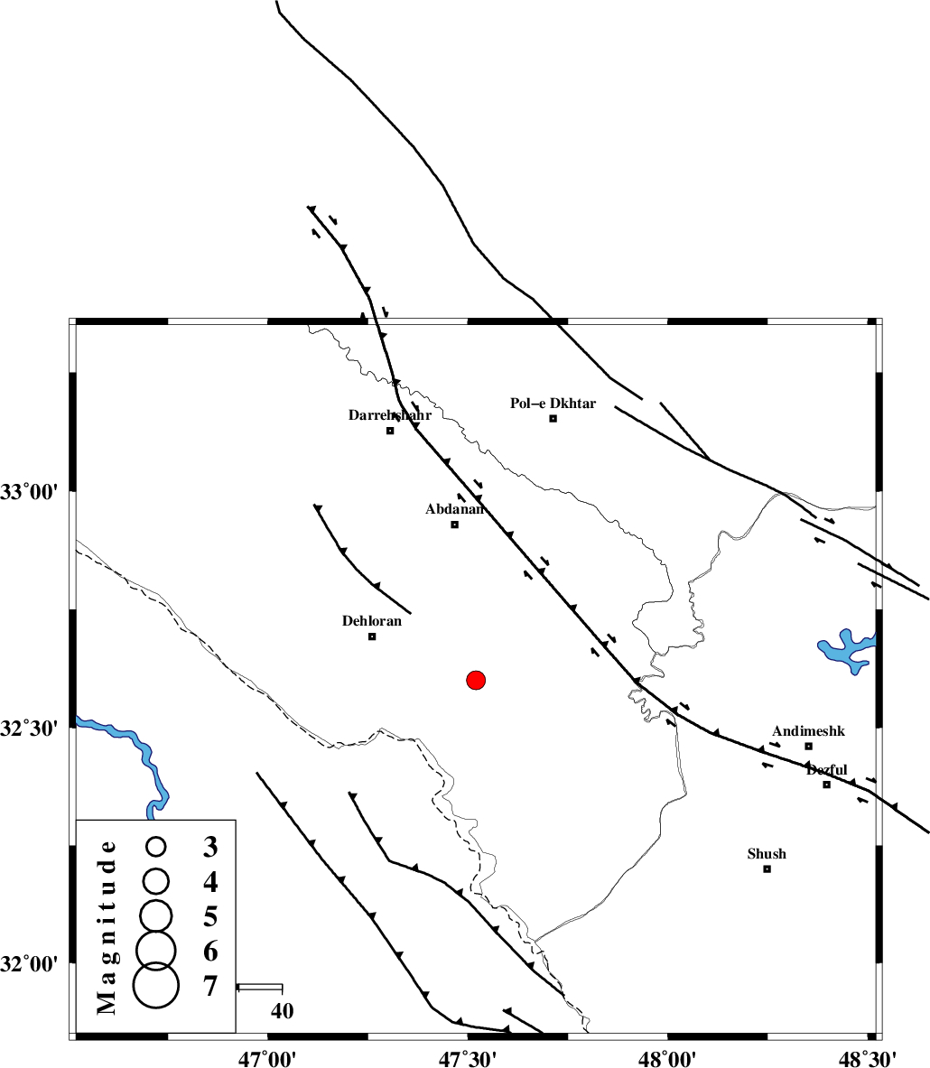
| Location | Lat:32.6 Lon: 47.52 |
| Region | Ilam Province, 27 km East of Dehloran |
Nearest Cities |
|
| 16 km North East of Musian, Ilam Province | |
| 26 km East of Dehloran, Ilam Province | |
| 33 km South of Sarabbagh, Ilam Province | |
| 37 km South of Abdanan, Ilam Province | |
| 57 km South East of Bishehzar, Ilam Province | |
| Depth | 14 km |
| Agency | |
Faults within 150 km: |
|
| MFF6 (Length: 144 km) , Distance to epicenter: 10 km | |
| BALARUD_F_Z1 (Length: 87 km) , Distance to epicenter: 37 km | |
| BALARUD_F_Z3 (Length: 53 km) , Distance to epicenter: 57 km | |
| Number of Phases | 6 |
| RMS | 0.1 |
| Number of Stations | 3 |
| Error in Latitude | >1.9 km |
| Error in Longitude | 3 km |
| Error in Depth | 4.4 km |
Download waveform in seisan format
to download seisan software Click here
to access information about IIEES stations Click here
Amplitude | ||||||||
| UID | Agency | Station | Component | Amplitude | Period | Arrival Time | Proccessing Time | Signal Clip |
| 80020 | IIEES | SHGR | N | 338.5 | 0.44 | 2011-08-18 11:17:52 | 2011-08-18 12:18:00 | n |
| 80021 | IIEES | SHGR | E | 841.1 | 0.76 | 2011-08-18 11:17:52 | 2011-08-18 12:18:00 | n |
| 80022 | IIEES | KHMZ | N | 36.8 | 0.56 | 2011-08-18 11:18:36 | 2011-08-18 12:18:00 | n |
| 80023 | IIEES | KHMZ | E | 29.7 | 0.6 | 2011-08-18 11:18:39 | 2011-08-18 12:18:00 | n |
| 80024 | IIEES | SNGE | N | 49.6 | 0.44 | 2011-08-18 11:18:37 | 2011-08-18 12:18:00 | n |
| 80025 | IIEES | SNGE | E | 50.7 | 0.68 | 2011-08-18 11:18:37 | 2011-08-18 12:18:00 | n |
Phase | ||||||||||||
| Agency | Station | Component | Phase Type | Phase Quality | First Motion | Observed Arrival Time | Time Residual | Loc. Flag | Input Weight | Distance | Azimuth | |
| IIEES | SHGR | N | Pg | E | 2011-08-18 11:17:31 | -0.19 | y | 132 | 114 | |||
| IIEES | SHGR | E | Sg | E | 2011-08-18 11:17:47 | 0.03 | y | 132 | 114 | |||
| IIEES | KHMZ | E | Pn | E | 2011-08-18 11:17:50 | 0.11 | y | 261 | 60 | |||
| IIEES | KHMZ | E | Sg | E | 2011-08-18 11:18:23 | 0.02 | y | 261 | 60 | |||
| IIEES | SNGE | Z | Pn | E | 2011-08-18 11:17:52 | 0.16 | y | 277 | 357 | |||
| IIEES | SNGE | E | Sg | E | 2011-08-18 11:18:27 | -0.13 | y | 277 | 357 | |||