
Magnitude |
:2.9 |
| Date & Time (UTC) | 2011-08-17 03:40:10.5 |
| Date & Time (Local) | 1390/5/26 08:10:10.5 |
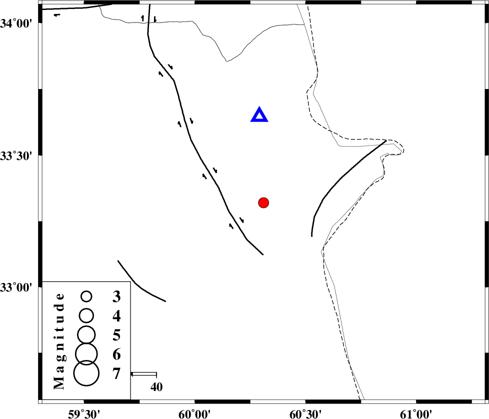
| Location | Lat:33.32 Lon: 60.31 |
| Region | Khorasan(south) Province, 91 km North-East of Sarbisheh |
Nearest Cities |
|
| 37 km North of Gazik, Khorasan(south) Province | |
| 39 km South East of Shahdokht, Khorasan(south) Province | |
| 48 km South East of Hajiabad, Khorasan(south) Province | |
| 49 km East of Zahan, Khorasan(south) Province | |
| 53 km South East of Abiz, Khorasan(south) Province | |
| Depth | 21 km |
| Agency | |
Faults within 150 km: |
|
| ABRIZ_F (Length: 114 km) , Distance to epicenter: 15 km | |
| PATARGAN_F (Length: 52 km) , Distance to epicenter: 22 km | |
| NOZAD_F (Length: 27 km) , Distance to epicenter: 59 km | |
| Number of Phases | 5 |
| RMS | 0.1 |
| Number of Stations | 5 |
| Error in Latitude | >3.9 km |
| Error in Longitude | 6.9 km |
| Error in Depth | 7.4 km |
Download waveform in seisan format
to download seisan software Click here
to access information about IIEES stations Click here
Amplitude | ||||||||
| UID | Agency | Station | Component | Amplitude | Period | Arrival Time | Proccessing Time | Signal Clip |
| 80000 | IIEES | SHRT | E | 1339.8 | 0.29 | 2011-08-17 03:40:27 | 2011-08-17 04:01:00 | n |
| 80001 | IIEES | SHRT | N | 1404.7 | 0.41 | 2011-08-17 03:40:28 | 2011-08-17 04:01:00 | n |
| 80002 | IIEES | KRBR | E | 11.3 | 0.49 | 2011-08-17 03:42:42 | 2011-08-17 04:01:00 | n |
| 80003 | IIEES | KRBR | N | 14.2 | 0.44 | 2011-08-17 03:42:43 | 2011-08-17 04:01:00 | n |
Phase | ||||||||||||
| Agency | Station | Component | Phase Type | Phase Quality | First Motion | Observed Arrival Time | Time Residual | Loc. Flag | Input Weight | Distance | Azimuth | |
| IIEES | SHRT | Z | Pg | E | 2011-08-17 03:40:17 | 0 | y | 36.4 | 357 | |||
| IIEES | TABS | Z | Pn | E | 2011-08-17 03:40:54 | 0.1 | y | 299 | 278 | |||
| IIEES | ZHSF | Z | Pn | E | 2011-08-17 03:41:09 | 0.04 | y | 413 | 174 | |||
| IIEES | SHRO | Z | Pn | E | 2011-08-17 03:41:18 | -0.08 | y | 494 | 308 | |||
| IIEES | KRBR | Z | Pn | E | 2011-08-17 03:41:19 | -0.1 | y | 500 | 223 | |||