
Magnitude |
:2.9 |
| Date & Time (UTC) | 2011-08-16 18:27:11.5 |
| Date & Time (Local) | 1390/5/25 22:57:11.5 |
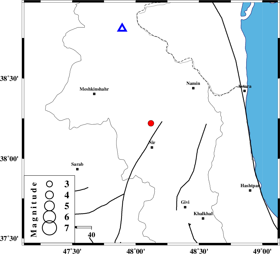
| Location | Lat:38.22 Lon: 48.12 |
| Region | Ardebil Province, 17 km North of Nir |
Nearest Cities |
|
| 2 km of Sardabeh, Ardebil Province | |
| 3 km North of Ardimusa, Ardebil Province | |
| 4 km North of Sareyin, Ardebil Province | |
| 7 km North of Varniab, Ardebil Province | |
| 9 km of Khoshkehrud, Ardebil Province | |
| Depth | 47 km |
| Agency | |
Faults within 150 km: |
|
| BOZQUSH (Length: 70 km) , Distance to epicenter: 8 km | |
| SANGAVAR_F (Length: 61 km) , Distance to epicenter: 36 km | |
| TALESH_F (Length: 258 km) , Distance to epicenter: 66 km | |
| Number of Phases | 4 |
| RMS | 0.2 |
| Number of Stations | 3 |
| Error in Latitude | >1 km |
| Error in Longitude | 3.3 km |
| Error in Depth | 19.8 km |
Download waveform in seisan format
to download seisan software Click here
to access information about IIEES stations Click here
Amplitude | ||||||||
| UID | Agency | Station | Component | Amplitude | Period | Arrival Time | Proccessing Time | Signal Clip |
| 79997 | IIEES | GRMI | E | 723.4 | 0.17 | 2011-08-16 18:27:35 | 2011-08-16 07:26:00 | n |
| 79998 | IIEES | GRMI | N | 572.7 | 0.14 | 2011-08-16 18:27:36 | 2011-08-16 07:26:00 | n |
| 79999 | IIEES | ZNJK | E | 75.6 | 0.81 | 2011-08-16 18:28:03 | 2011-08-16 07:26:00 | n |
Phase | ||||||||||||
| Agency | Station | Component | Phase Type | Phase Quality | First Motion | Observed Arrival Time | Time Residual | Loc. Flag | Input Weight | Distance | Azimuth | |
| IIEES | GRMI | Z | Pg | E | 2011-08-16 18:27:25 | 0.28 | y | 68.5 | 344 | |||
| IIEES | GRMI | E | Sg | E | 2011-08-16 18:27:34 | -0.2 | y | 68.5 | 344 | |||
| IIEES | ZNJK | Z | Pg | E | 2011-08-16 18:27:38 | -0.07 | y | 179 | 164 | |||
| IIEES | CHTH | Z | Pn | E | 2011-08-16 18:27:57 | y | 371 | 133 | ||||