
Magnitude |
:3.1 |
| Date & Time (UTC) | 2011-08-07 15:03:37.9 |
| Date & Time (Local) | 1390/5/16 19:33:37.9 |
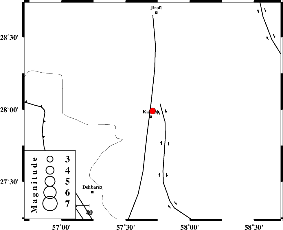
| Location | Lat:27.99 Lon: 57.71 |
| Region | Kerman Province, 4 km Kahnuj |
Nearest Cities |
|
| 5 km North of Kahnuj, Kerman Province | |
| 30 km South East of Bolock, Kerman Province | |
| 32 km South East of Mehrueye-e paeen, Kerman Province | |
| 40 km North of Bargah, Kerman Province | |
| 44 km East of Faryab, Kerman Province | |
| Depth | 14 km |
| Agency | |
Faults within 150 km: |
|
| SABZEVARAN_F (Length: 190 km) , Distance to epicenter: 6 km | |
| JIROFT_F (Length: 144 km) , Distance to epicenter: 8 km | |
| ZENDAN_MINAB_F_Z1 (Length: 183 km) , Distance to epicenter: 82 km | |
| Number of Phases | 5 |
| RMS | 0 |
| Number of Stations | 3 |
| Error in Latitude | >1.3 km |
| Error in Longitude | 2.8 km |
| Error in Depth | 5.5 km |
Download waveform in seisan format
to download seisan software Click here
to access information about IIEES stations Click here
Amplitude | ||||||||
| UID | Agency | Station | Component | Amplitude | Period | Arrival Time | Proccessing Time | Signal Clip |
| 79936 | IIEES | BNDS | E | 236.8 | 0.32 | 2011-08-07 15:04:27 | 2011-08-07 03:13:00 | n |
| 79937 | IIEES | BNDS | N | 200.7 | 0.24 | 2011-08-07 15:04:32 | 2011-08-07 03:13:00 | n |
| 79938 | IIEES | KRBR | N | 125.8 | 0.32 | 2011-08-07 15:04:48 | 2011-08-07 03:13:00 | n |
Phase | ||||||||||||
| Agency | Station | Component | Phase Type | Phase Quality | First Motion | Observed Arrival Time | Time Residual | Loc. Flag | Input Weight | Distance | Azimuth | |
| IIEES | BNDS | Z | Pg | E | 2011-08-07 15:04:05 | -0.04 | y | 165 | 247 | |||
| IIEES | BNDS | E | Sg | E | 2011-08-07 15:04:25 | 0.02 | y | 165 | 247 | |||
| IIEES | KRBR | Z | Pn | E | 2011-08-07 15:04:15 | 0.09 | y | 240 | 337 | |||
| IIEES | KRBR | N | Sg | E | 2011-08-07 15:04:46 | -0.04 | y | 240 | 337 | |||
| IIEES | ZHSF | Z | Pn | E | 2011-08-07 15:04:29 | -0.02 | y | 349 | 58 | |||