
Magnitude |
:4.1 |
| Date & Time (UTC) | 2011-08-02 18:08:34.2 |
| Date & Time (Local) | 1390/5/11 22:38:34.2 |
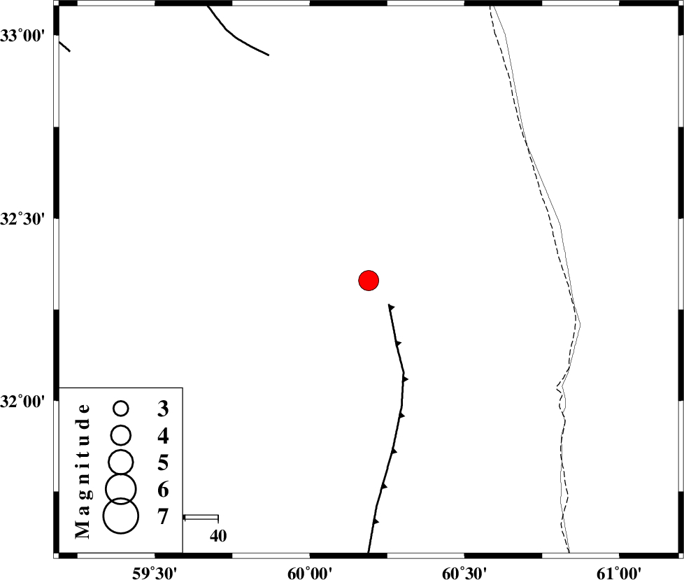
| Location | Lat:32.33 Lon: 60.19 |
| Region | Khorasan(south) Province, 50 km South-East of Sarbisheh |
Nearest Cities |
|
| 36 km West of Dorj, Khorasan(south) Province | |
| 45 km South East of Salmabad, Khorasan(south) Province | |
| 47 km North East of Shusef, Khorasan(south) Province | |
| 50 km South East of Sarbisheh, Khorasan(south) Province | |
| 53 km South of Tabas masina, Khorasan(south) Province | |
| Depth | 46 km |
| Agency | |
Faults within 150 km: |
|
| E_NEH_F (Length: 148 km) , Distance to epicenter: 9 km | |
| NOZAD_F (Length: 27 km) , Distance to epicenter: 75 km | |
| ABRIZ_F (Length: 114 km) , Distance to epicenter: 89 km | |
| Number of Phases | 6 |
| RMS | 0.1 |
| Number of Stations | 6 |
| Error in Latitude | >2.4 km |
| Error in Longitude | 5.2 km |
| Error in Depth | 5.7 km |
Download waveform in seisan format
to download seisan software Click here
to access information about IIEES stations Click here
Amplitude | ||||||||
| UID | Agency | Station | Component | Amplitude | Period | Arrival Time | Proccessing Time | Signal Clip |
| 79892 | IIEES | SHRT | E | 1653.4 | 0.65 | 2011-08-02 18:09:29 | 2011-08-02 06:32:00 | n |
| 79893 | IIEES | TABS | N | 292.2 | 0.42 | 2011-08-02 18:10:13 | 2011-08-02 06:32:00 | n |
| 79894 | IIEES | KRBR | N | 464.1 | 0.35 | 2011-08-02 18:10:35 | 2011-08-02 06:32:00 | n |
| 79895 | IIEES | KRBR | E | 516.6 | 0.24 | 2011-08-02 18:10:36 | 2011-08-02 06:32:00 | n |
Phase | ||||||||||||
| Agency | Station | Component | Phase Type | Phase Quality | First Motion | Observed Arrival Time | Time Residual | Loc. Flag | Input Weight | Distance | Azimuth | |
| IIEES | SHRT | Z | Pg | E | 2011-08-02 18:08:58 | 0 | y | 147 | 4 | |||
| IIEES | ZHSF | Z | Pn | E | 2011-08-02 18:09:17 | -0.01 | y | 306 | 169 | |||
| IIEES | TABS | Z | Pn | E | 2011-08-02 18:09:18 | -0.11 | y | 322 | 298 | |||
| IIEES | KRBR | Z | Pn | E | 2011-08-02 18:09:31 | 0.03 | y | 418 | 232 | |||
| IIEES | SHRO | Z | Pn | E | 2011-08-02 18:09:48 | 0.23 | y | 561 | 318 | |||
| IIEES | BJRD | Z | Pn | E | 2011-08-02 18:09:59 | -0.1 | y | 648 | 338 | |||