
Magnitude |
:2.8 |
| Date & Time (UTC) | 2011-08-02 14:44:50.7 |
| Date & Time (Local) | 1390/5/11 19:14:50.7 |
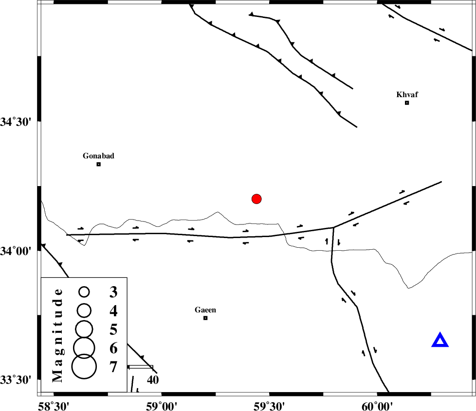
| Location | Lat:34.2 Lon: 59.44 |
| Region | Khorasan(center) Province, 55 km North-East of Qaen |
Nearest Cities |
|
| 40 km West of Ebrahimi, Khorasan(center) Province | |
| 43 km South West of Zuzan, Khorasan(center) Province | |
| 44 km South West of Qasemabad, Khorasan(center) Province | |
| 49 km South East of Bimorgh, Khorasan(center) Province | |
| 50 km North East of Eslamabad, Khorasan(south) Province | |
| Depth | 14 km |
| Agency | |
Faults within 150 km: |
|
| DASHT_E_BAYAZ_F (Length: 177 km) , Distance to epicenter: 17 km | |
| ABRIZ_F (Length: 114 km) , Distance to epicenter: 35 km | |
| JANGAL_F (Length: 111 km) , Distance to epicenter: 50 km | |
| Number of Phases | 4 |
| RMS | 0 |
| Number of Stations | 3 |
| Error in Latitude | >4.6 km |
| Error in Longitude | 7.7 km |
| Error in Depth | 13.9 km |
Download waveform in seisan format
to download seisan software Click here
to access information about IIEES stations Click here
Amplitude | ||||||||
| UID | Agency | Station | Component | Amplitude | Period | Arrival Time | Proccessing Time | Signal Clip |
| 79889 | IIEES | SHRT | E | 370.2 | 0.3 | 2011-08-02 14:45:24 | 2011-08-02 03:35:00 | n |
| 79890 | IIEES | SHRT | N | 288.3 | 0.54 | 2011-08-02 14:45:24 | 2011-08-02 03:35:00 | n |
| 79891 | IIEES | TABS | N | 53.2 | 0.23 | 2011-08-02 14:45:58 | 2011-08-02 03:35:00 | n |
Phase | ||||||||||||
| Agency | Station | Component | Phase Type | Phase Quality | First Motion | Observed Arrival Time | Time Residual | Loc. Flag | Input Weight | Distance | Azimuth | |
| IIEES | SHRT | Z | Pg | E | 2011-08-02 14:45:08 | -0.07 | y | 99.2 | 128 | |||
| IIEES | SHRT | E | Sg | E | 2011-08-02 14:45:20 | 0.05 | y | 99.2 | 128 | |||
| IIEES | TABS | Z | Pn | E | 2011-08-02 14:45:26 | 0 | y | 223 | 255 | |||
| IIEES | SHRO | Z | Pn | E | 2011-08-02 14:45:45 | 0.03 | y | 372 | 304 | |||