
Magnitude |
:3.3 |
| Date & Time (UTC) | 2011-08-02 10:54:07.0 |
| Date & Time (Local) | 1390/5/11 15:24:07.0 |
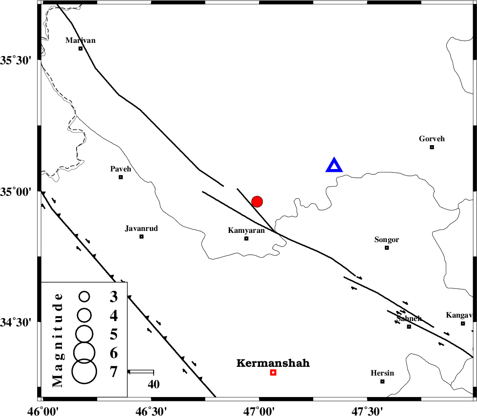
| Location | Lat:34.96 Lon: 46.99 |
| Region | Kordestan Province, 16 km North of Kamyaran |
Nearest Cities |
|
| 2 km of Yoosefabad, Kurdistan Province | |
| 7 km of Void, Kurdistan Province | |
| 7 km of Void, Kurdistan Province | |
| 10 km East of Kuleh sareh, Kurdistan Province | |
| 16 km North of Kamyaran, Kurdistan Province | |
| Depth | 15 km |
| Agency | |
Faults within 150 km: |
|
| SARTAKHT_F (Length: 78 km) , Distance to epicenter: 9 km | |
| MORVARID_F (Length: 24 km) , Distance to epicenter: 10 km | |
| PIRANSHAHR_F (Length: 253 km) , Distance to epicenter: 15 km | |
| Number of Phases | 5 |
| RMS | 0.2 |
| Number of Stations | 6 |
| Error in Latitude | >3 km |
| Error in Longitude | 6.8 km |
| Error in Depth | 0 km |
Download waveform in seisan format
to download seisan software Click here
to access information about IIEES stations Click here
Amplitude | ||||||||
| UID | Agency | Station | Component | Amplitude | Period | Arrival Time | Proccessing Time | Signal Clip |
| 79882 | IIEES | SNGE | E | 3229 | 0.12 | 2011-08-02 10:54:14 | 2011-08-02 11:07:00 | n |
| 79883 | IIEES | KHMZ | N | 116.6 | 0.52 | 2011-08-02 10:55:38 | 2011-08-02 11:07:00 | n |
| 79884 | IIEES | GHVR | E | 53.6 | 0.6 | 2011-08-02 10:56:16 | 2011-08-02 11:07:00 | n |
| 79885 | IIEES | GHVR | N | 55 | 0.76 | 2011-08-02 10:56:18 | 2011-08-02 11:07:00 | n |
Phase | ||||||||||||
| Agency | Station | Component | Phase Type | Phase Quality | First Motion | Observed Arrival Time | Time Residual | Loc. Flag | Input Weight | Distance | Azimuth | |
| IIEES | ZNJK | Z | Pn | E | 2011-08-02 10:54:45 | 0.03 | y | 244 | 38 | |||
| IIEES | ASAO | Z | Pn | E | 2011-08-02 10:54:49 | -0.21 | y | 282 | 98 | |||
| IIEES | KHMZ | Z | Pn | E | 2011-08-02 10:54:53 | 0.32 | y | 306 | 115 | |||
| IIEES | SHGR | Z | Pn | E | 2011-08-02 10:54:58 | -0.09 | y | 358 | 151 | |||
| IIEES | GHVR | Z | Pn | E | 2011-08-02 10:55:03 | -0.07 | y | 394 | 97 | |||