
Magnitude |
:3.4 |
| Date & Time (UTC) | 2011-08-01 15:07:55.3 |
| Date & Time (Local) | 1390/5/10 19:37:55.3 |
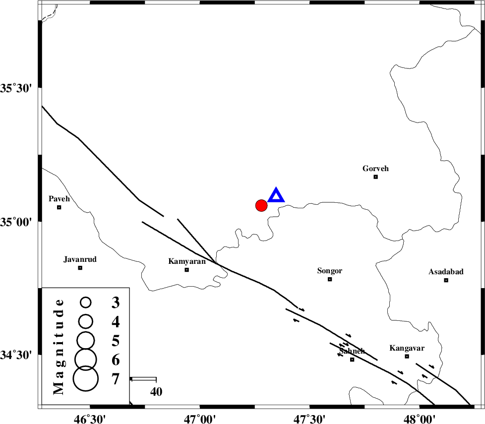
| Location | Lat:35.06 Lon: 47.28 |
| Region | Kordestan Province, 38 km South-East of Sanandaj |
Nearest Cities |
|
| 11 km East of Muchesh, Kurdistan Province | |
| 18 km North West of Void, Kermanshah Province | |
| 18 km West of Laleh, Kurdistan Province | |
| 20 km North West of Agah olia, Kermanshah Province | |
| 23 km North of Shirkuh, Kermanshah Province | |
| Depth | 14 km |
| Agency | |
Faults within 150 km: |
|
| SARTAKHT_F (Length: 78 km) , Distance to epicenter: 30 km | |
| MORVARID_F (Length: 24 km) , Distance to epicenter: 31 km | |
| PIRANSHAHR_F (Length: 253 km) , Distance to epicenter: 41 km | |
| Number of Phases | 4 |
| RMS | 0 |
| Number of Stations | 3 |
| Error in Latitude | >4.3 km |
| Error in Longitude | 7.7 km |
| Error in Depth | 1.5 km |
Download waveform in seisan format
to download seisan software Click here
to access information about IIEES stations Click here
Amplitude | ||||||||
| UID | Agency | Station | Component | Amplitude | Period | Arrival Time | Proccessing Time | Signal Clip |
| 79873 | IIEES | KHMZ | N | 154.5 | 0.44 | 2011-08-01 15:09:24 | 2011-08-01 03:45:00 | n |
| 79874 | IIEES | KHMZ | E | 199.1 | 0.52 | 2011-08-01 15:09:28 | 2011-08-01 03:45:00 | n |
Phase | ||||||||||||
| Agency | Station | Component | Phase Type | Phase Quality | First Motion | Observed Arrival Time | Time Residual | Loc. Flag | Input Weight | Distance | Azimuth | |
| IIEES | SNGE | N | Sg | E | 2011-08-01 15:08:00 | -0.07 | y | 7.08 | 63 | |||
| IIEES | ZNJK | N | Pn | E | 2011-08-01 15:08:30 | 0.06 | y | 219 | 35 | |||
| IIEES | KHMZ | E | Pn | E | 2011-08-01 15:08:38 | -0.01 | y | 287 | 120 | |||
| IIEES | KHMZ | E | Sg | E | 2011-08-01 15:09:16 | 0.02 | y | 287 | 120 | |||