
Magnitude |
:3 |
| Date & Time (UTC) | 2011-08-01 04:58:05.4 |
| Date & Time (Local) | 1390/5/10 09:28:05.4 |
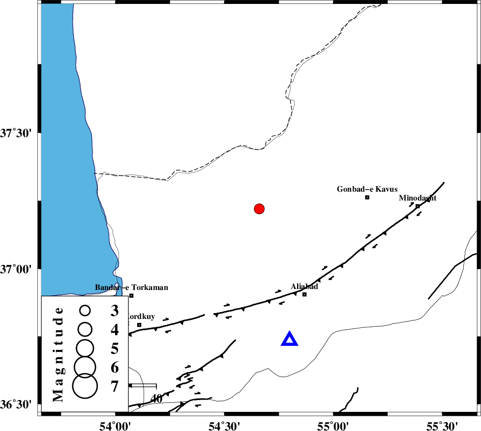
| Location | Lat:37.22 Lon: 54.66 |
| Region | Golestan Province, 29 km North-East of Aq Qaleh |
Nearest Cities |
|
| 17 km North of Gariduji, Golestan Province | |
| 26 km South of Enchehborun, Golestan Province | |
| 27 km North East of Qanqarmeh, Golestan Province | |
| 28 km North of Nodeh malek, Golestan Province | |
| 29 km North East of Aq Qaleh, Golestan Province | |
| Depth | 16 km |
| Agency | |
Faults within 150 km: |
|
| KHAZAR_F (Length: 523 km) , Distance to epicenter: 36 km | |
| SHAVAR_F (Length: 87 km) , Distance to epicenter: 68 km | |
| N_ALBORZ_F (Length: 360 km) , Distance to epicenter: 72 km | |
| Number of Phases | 5 |
| RMS | 0.1 |
| Number of Stations | 5 |
| Error in Latitude | >2.7 km |
| Error in Longitude | 3.7 km |
| Error in Depth | 6.1 km |
Download waveform in seisan format
to download seisan software Click here
to access information about IIEES stations Click here
Amplitude | ||||||||
| UID | Agency | Station | Component | Amplitude | Period | Arrival Time | Proccessing Time | Signal Clip |
| 79868 | IIEES | MRVT | N | 335.7 | 0.23 | 2011-08-01 04:58:49 | 2011-08-01 05:15:00 | n |
| 79869 | IIEES | DAMV | E | 66.9 | 0.22 | 2011-08-01 04:59:35 | 2011-08-01 05:15:00 | n |
| 79870 | IIEES | DAMV | N | 40.6 | 0.47 | 2011-08-01 04:59:36 | 2011-08-01 05:15:00 | n |
| 79871 | IIEES | GHVR | E | 23.5 | 0.5 | 2011-08-01 05:00:14 | 2011-08-01 05:15:00 | n |
| 79872 | IIEES | GHVR | N | 21.4 | 0.35 | 2011-08-01 05:00:15 | 2011-08-01 05:15:00 | n |
Phase | ||||||||||||
| Agency | Station | Component | Phase Type | Phase Quality | First Motion | Observed Arrival Time | Time Residual | Loc. Flag | Input Weight | Distance | Azimuth | |
| IIEES | MRVT | Z | Pg | E | 2011-08-01 04:58:28 | 0.01 | y | 136 | 68 | |||
| IIEES | SHRO | Z | Pg | E | 2011-08-01 04:58:35 | -0.01 | y | 181 | 138 | |||
| IIEES | DAMV | Z | Pn | E | 2011-08-01 04:58:50 | -0.08 | y | 299 | 235 | |||
| IIEES | GHVR | Z | Pn | E | 2011-08-01 04:59:06 | 0.11 | y | 433 | 226 | |||
| IIEES | TABS | Z | Pn | E | 2011-08-01 04:59:09 | -0.01 | y | 454 | 150 | |||