
Magnitude |
:3 |
| Date & Time (UTC) | 2011-07-27 03:18:44.7 |
| Date & Time (Local) | 1390/5/5 07:48:44.7 |
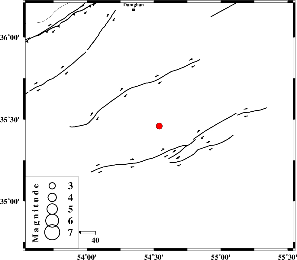
| Location | Lat:35.46 Lon: 54.54 |
| Region | Semnan Province, 80 km South-East of Damghan |
Nearest Cities |
|
| 72 km South East of Amirabad, Semnan Province | |
| 75 km South East of Seydabad, Semnan Province | |
| 80 km South East of Damghan, Semnan Province | |
| 83 km South East of Darvar, Semnan Province | |
| 84 km South of Mehmandust, Semnan Province | |
| Depth | 14 km |
| Agency | |
Faults within 150 km: |
|
| TORUD_F (Length: 136 km) , Distance to epicenter: 19 km | |
| ATARI_F (Length: 185 km) , Distance to epicenter: 79 km | |
| MEYAMEY_F (Length: 141 km) , Distance to epicenter: 82 km | |
| Number of Phases | 6 |
| RMS | 0.1 |
| Number of Stations | 7 |
| Error in Latitude | >2.3 km |
| Error in Longitude | 2.4 km |
| Error in Depth | 5.6 km |
Download waveform in seisan format
to download seisan software Click here
to access information about IIEES stations Click here
Amplitude | ||||||||
| UID | Agency | Station | Component | Amplitude | Period | Arrival Time | Proccessing Time | Signal Clip |
| 79831 | IIEES | SHRO | E | 192.7 | 0.32 | 2011-07-27 03:19:30 | 2011-07-27 03:34:00 | n |
| 79832 | IIEES | SHRO | N | 157.9 | 0.24 | 2011-07-27 03:19:31 | 2011-07-27 03:34:00 | n |
| 79833 | IIEES | DAMV | E | 182.4 | 0.3 | 2011-07-27 03:19:56 | 2011-07-27 03:34:00 | n |
| 79834 | IIEES | TABS | E | 40.4 | 0.38 | 2011-07-27 03:20:18 | 2011-07-27 03:34:00 | n |
| 79835 | IIEES | TABS | N | 88 | 0.45 | 2011-07-27 03:20:26 | 2011-07-27 03:34:00 | n |
| 79836 | IIEES | GHVR | E | 55.6 | 0.45 | 2011-07-27 03:20:35 | 2011-07-27 03:34:00 | n |
| 79837 | IIEES | ASAO | N | 18.4 | 0.71 | 2011-07-27 03:20:56 | 2011-07-27 03:34:00 | n |
Phase | ||||||||||||
| Agency | Station | Component | Phase Type | Phase Quality | First Motion | Observed Arrival Time | Time Residual | Loc. Flag | Input Weight | Distance | Azimuth | |
| IIEES | SHRO | Z | Pg | E | 2011-07-27 03:19:09 | -0.01 | y | 146 | 65 | |||
| IIEES | DAMV | Z | Pn | E | 2011-07-27 03:19:21 | -0.16 | y | 234 | 275 | |||
| IIEES | MRVT | Z | Pn | E | 2011-07-27 03:19:27 | 0.08 | y | 281 | 29 | |||
| IIEES | TABS | Z | Pn | E | 2011-07-27 03:19:30 | -0.09 | y | 310 | 130 | |||
| IIEES | NASN | Z | Pn | E | 2011-07-27 03:19:34 | 0.11 | y | 336 | 209 | |||
| IIEES | ASAO | Z | Pn | E | 2011-07-27 03:19:45 | 0.09 | y | 424 | 257 | |||