
Magnitude |
:2.8 |
| Date & Time (UTC) | 2011-07-24 18:29:13.0 |
| Date & Time (Local) | 1390/5/2 22:59:13.0 |
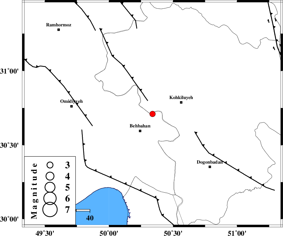
| Location | Lat:30.71 Lon: 50.34 |
| Region | Khoozestan Province, 16 km North of Behbahan |
Nearest Cities |
|
| 10 km North of Mansuriyeh, Khoozestan Province | |
| 15 km East of Dodange-ye bozorg, Khoozestan Province | |
| 16 km North of Behbahan, Khoozestan Province | |
| 23 km West of Dehdasht, Kohkiluieh va boyerahmad Province | |
| 31 km South of Lendeh, Kohkiluieh va boyerahmad Province | |
| Depth | 14 km |
| Agency | |
Faults within 150 km: |
|
| MFF4 (Length: 62 km) , Distance to epicenter: 11 km | |
| MISHAN_F (Length: 76 km) , Distance to epicenter: 34 km | |
| AGHAJARI_F (Length: 88 km) , Distance to epicenter: 46 km | |
| Number of Phases | 5 |
| RMS | 0.1 |
| Number of Stations | 3 |
| Error in Latitude | >4.1 km |
| Error in Longitude | 3.7 km |
| Error in Depth | 4.6 km |
Download waveform in seisan format
to download seisan software Click here
to access information about IIEES stations Click here
Amplitude | ||||||||
| UID | Agency | Station | Component | Amplitude | Period | Arrival Time | Proccessing Time | Signal Clip |
| 79783 | IIEES | SHGR | N | 176.4 | 0.56 | 2011-07-24 18:30:17 | 2011-07-24 06:51:00 | n |
| 79784 | IIEES | SHGR | E | 193.6 | 0.44 | 2011-07-24 18:30:17 | 2011-07-24 06:51:00 | n |
| 79785 | IIEES | KHMZ | N | 12.6 | 0.56 | 2011-07-24 18:30:57 | 2011-07-24 06:51:00 | n |
| 79786 | IIEES | KHMZ | E | 17 | 0.44 | 2011-07-24 18:31:00 | 2011-07-24 06:51:00 | n |
Phase | ||||||||||||
| Agency | Station | Component | Phase Type | Phase Quality | First Motion | Observed Arrival Time | Time Residual | Loc. Flag | Input Weight | Distance | Azimuth | |
| IIEES | SHGR | Z | P | E | 2011-07-24 18:29:47 | 0.1 | y | 213 | 317 | |||
| IIEES | SHGR | E | Sg | E | 2011-07-24 18:30:13 | -0.04 | y | 213 | 317 | |||
| IIEES | NASN | Z | Pn | E | 2011-07-24 18:30:01 | 0.01 | y | 329 | 45 | |||
| IIEES | KHMZ | Z | Pn | E | 2011-07-24 18:30:02 | -0.16 | y | 338 | 354 | |||
| IIEES | KHMZ | E | S | E | 2011-07-24 18:30:39 | 0.08 | y | 338 | 354 | |||