
Magnitude |
:3.1 |
| Date & Time (UTC) | 2011-06-29 10:20:51.4 |
| Date & Time (Local) | 1390/4/8 14:50:51.4 |
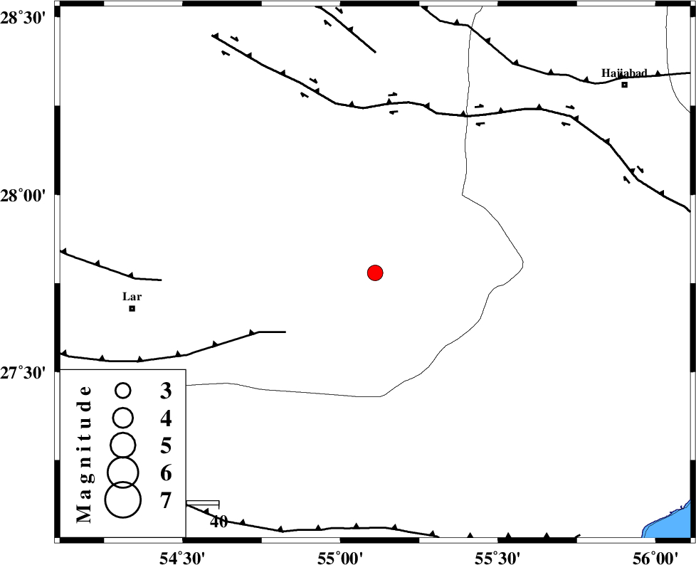
| Location | Lat:27.78 Lon: 55.11 |
| Region | Fars Province, 76 km North-East of Lar |
Nearest Cities |
|
| 32 km West of Darz, Fars Province | |
| 48 km South of Fadami, Fars Province | |
| 59 km South of Doborji, Fars Province | |
| 68 km East of Dehkuyeh, Fars Province | |
| 72 km North East of Latifi, Fars Province | |
| Depth | 15 km |
| Agency | |
Faults within 150 km: |
|
| LAR_F (Length: 99 km) , Distance to epicenter: 34 km | |
| HZF2 (Length: 437 km) , Distance to epicenter: 52 km | |
| BERIZ_F (Length: 49 km) , Distance to epicenter: 67 km | |
| Number of Phases | 4 |
| RMS | 0 |
| Number of Stations | 3 |
| Error in Latitude | >1.7 km |
| Error in Longitude | 3 km |
| Error in Depth | 5.8 km |
Download waveform in seisan format
to download seisan software Click here
to access information about IIEES stations Click here
Amplitude | ||||||||
| UID | Agency | Station | Component | Amplitude | Period | Arrival Time | Proccessing Time | Signal Clip |
| 79470 | IIEES | BNDS | E | 476.6 | 0.34 | 2011-06-29 10:21:28 | 2011-06-29 11:06:00 | n |
| 79471 | IIEES | BNDS | N | 375 | 0.34 | 2011-06-29 10:21:32 | 2011-06-29 11:06:00 | n |
| 79472 | IIEES | KRBR | E | 76.1 | 0.45 | 2011-06-29 10:22:19 | 2011-06-29 11:06:00 | n |
| 79473 | IIEES | KRBR | N | 75 | 0.71 | 2011-06-29 10:22:22 | 2011-06-29 11:06:00 | n |
Phase | ||||||||||||
| Agency | Station | Component | Phase Type | Phase Quality | First Motion | Observed Arrival Time | Time Residual | Loc. Flag | Input Weight | Distance | Azimuth | |
| IIEES | BNDS | Z | Pg | E | 2011-06-29 10:21:10 | 0 | y | 113 | 112 | |||
| IIEES | GHIR | Z | Pn | E | 2011-06-29 10:21:25 | 0 | y | 216 | 285 | |||
| IIEES | KRBR | N | Pn | E | 2011-06-29 10:21:35 | 0 | y | 292 | 33 | |||
| IIEES | KRBR | N | Sg | E | 2011-06-29 10:22:13 | 0 | y | 292 | 33 | |||