
Magnitude |
:2.8 |
| Date & Time (UTC) | 2011-06-25 19:34:56.8 |
| Date & Time (Local) | 1390/4/5 00:04:56.8 |
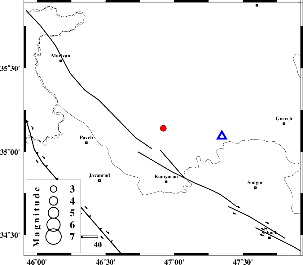
| Location | Lat:35.14 Lon: 46.92 |
| Region | Kordestan Province, 21 km South of Sanandaj |
Nearest Cities |
|
| 3 km North of Ali Abad, Kurdistan Province | |
| 12 km East of Turivar, Kurdistan Province | |
| 14 km North of Void, Kurdistan Province | |
| 14 km North of Void, Kurdistan Province | |
| 16 km South of Gorizeh, Kurdistan Province | |
| Depth | 14 km |
| Agency | |
Faults within 150 km: |
|
| MORVARID_F (Length: 24 km) , Distance to epicenter: 15 km | |
| PIRANSHAHR_F (Length: 253 km) , Distance to epicenter: 15 km | |
| SARTAKHT_F (Length: 78 km) , Distance to epicenter: 23 km | |
| Number of Phases | 5 |
| RMS | 0.5 |
| Number of Stations | 4 |
| Error in Latitude | >9.3 km |
| Error in Longitude | 33.2 km |
| Error in Depth | 19.5 km |
Download waveform in seisan format
to download seisan software Click here
to access information about IIEES stations Click here
Amplitude | ||||||||
| UID | Agency | Station | Component | Amplitude | Period | Arrival Time | Proccessing Time | Signal Clip |
| 79402 | IIEES | ASAO | N | 37.5 | 1.13 | 2011-06-25 19:36:39 | 2011-06-25 08:14:00 | n |
| 79403 | IIEES | KHMZ | E | 37 | 2.29 | 2011-06-25 19:36:42 | 2011-06-25 08:14:00 | n |
| 79404 | IIEES | KHMZ | N | 38.7 | 0.33 | 2011-06-25 19:36:46 | 2011-06-25 08:14:00 | n |
Phase | ||||||||||||
| Agency | Station | Component | Phase Type | Phase Quality | First Motion | Observed Arrival Time | Time Residual | Loc. Flag | Input Weight | Distance | Azimuth | |
| IIEES | SNGE | Z | Pg | E | 2011-06-25 19:35:03 | -0.7 | y | 39.4 | 98 | |||
| IIEES | ZNJK | Z | Pg | E | 2011-06-25 19:35:34 | -0.4 | y | 233 | 43 | |||
| IIEES | ZNJK | N | Sg | E | 2011-06-25 19:36:03 | 0.3 | y | 233 | 43 | |||
| IIEES | ASAO | Z | Pn | E | 2011-06-25 19:35:41 | 0.5 | y | 292 | 102 | |||
| IIEES | KHMZ | Z | Pn | E | 2011-06-25 19:35:44 | 0.4 | y | 320 | 118 | |||