
Magnitude |
:3.5 |
| Date & Time (UTC) | 2011-05-31 13:45:18.9 |
| Date & Time (Local) | 1390/3/10 18:15:18.9 |
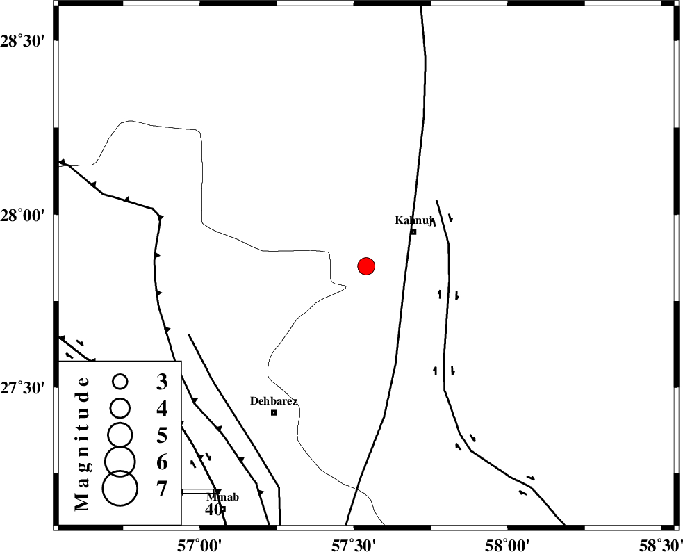
| Location | Lat:27.85 Lon: 57.54 |
| Region | Kerman Province, 18 km West of Kahnuj |
Nearest Cities |
|
| 19 km South West of Kahnuj, Kerman Province | |
| 26 km North East of Fariab, Hormozgan Province | |
| 27 km North West of Bargah, Kerman Province | |
| 29 km North of Bejogan, Kerman Province | |
| 30 km South East of Mehrueye-e paeen, Kerman Province | |
| Depth | 14 km |
| Agency | |
Faults within 150 km: |
|
| SABZEVARAN_F (Length: 190 km) , Distance to epicenter: 13 km | |
| JIROFT_F (Length: 144 km) , Distance to epicenter: 27 km | |
| ZENDAN_MINAB_F_Z1 (Length: 183 km) , Distance to epicenter: 61 km | |
| Number of Phases | 4 |
| RMS | 0.1 |
| Number of Stations | 3 |
| Error in Latitude | >2.8 km |
| Error in Longitude | 9.8 km |
| Error in Depth | 5.7 km |
Download waveform in seisan format
to download seisan software Click here
to access information about IIEES stations Click here
Amplitude | ||||||||
| UID | Agency | Station | Component | Amplitude | Period | Arrival Time | Proccessing Time | Signal Clip |
| 79189 | IIEES | BNDS | E | 1465.7 | 0.56 | 2011-05-31 13:46:01 | 2011-05-31 02:04:00 | n |
| 79190 | IIEES | BNDS | N | 806.3 | 0.15 | 2011-05-31 13:46:02 | 2011-05-31 02:04:00 | n |
| 79191 | IIEES | KRBR | E | 153.8 | 0.59 | 2011-05-31 13:46:31 | 2011-05-31 02:04:00 | n |
Phase | ||||||||||||
| Agency | Station | Component | Phase Type | Phase Quality | First Motion | Observed Arrival Time | Time Residual | Loc. Flag | Input Weight | Distance | Azimuth | |
| IIEES | BNDS | Z | Pg | E | 2011-05-31 13:45:42 | -0.1 | y | 145 | 250 | |||
| IIEES | KRBR | Z | Pg | E | 2011-05-31 13:45:59 | 0 | y | 248 | 342 | |||
| IIEES | KRBR | E | Sg | E | 2011-05-31 13:46:29 | 0 | y | 248 | 342 | |||
| IIEES | GHIR | Z | Pn | E | 2011-05-31 13:46:22 | 0.1 | y | 451 | 277 | |||