
Magnitude |
:3.4 |
| Date & Time (UTC) | 2011-05-16 11:12:26.6 |
| Date & Time (Local) | 1390/2/26 15:42:26.6 |
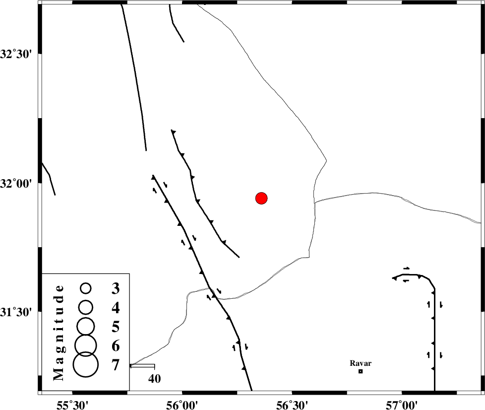
| Location | Lat:31.94 Lon: 56.36 |
| Region | Yazd Province, 87 km North-West of Ravar |
Nearest Cities |
|
| 32 km North East of Behabad, Yazd Province | |
| 33 km North East of Asfih, Yazd Province | |
| 35 km North East of Benestan, Yazd Province | |
| 59 km North of Kuhbanan, Kerman Province | |
| 59 km North East of Kushk, Yazd Province | |
| Depth | 17 km |
| Agency | |
Faults within 150 km: |
|
| JAFARABAD_F (Length: 60 km) , Distance to epicenter: 24 km | |
| KUHBANAN_F (Length: 189 km) , Distance to epicenter: 36 km | |
| SARBALA_F (Length: 92 km) , Distance to epicenter: 53 km | |
| Number of Phases | 5 |
| RMS | 0 |
| Number of Stations | 4 |
| Error in Latitude | >1 km |
| Error in Longitude | 4 km |
| Error in Depth | 4.2 km |
Download waveform in seisan format
to download seisan software Click here
to access information about IIEES stations Click here
Amplitude | ||||||||
| UID | Agency | Station | Component | Amplitude | Period | Arrival Time | Proccessing Time | Signal Clip |
| 79010 | IIEES | TABS | N | 237.5 | 0.58 | 2011-05-16 11:13:32 | 2011-05-16 11:23:00 | n |
| 79011 | IIEES | KRBR | E | 389.1 | 0.33 | 2011-05-16 11:13:31 | 2011-05-16 11:23:00 | n |
Phase | ||||||||||||
| Agency | Station | Component | Phase Type | Phase Quality | First Motion | Observed Arrival Time | Time Residual | Loc. Flag | Input Weight | Distance | Azimuth | |
| IIEES | TABS | Z | Pg | E | 2011-05-16 11:12:59 | 0 | y | 202 | 20 | |||
| IIEES | KRBR | Z | Pn | E | 2011-05-16 11:13:01 | 0 | y | 221 | 170 | |||
| IIEES | KRBR | N | Sg | E | 2011-05-16 11:13:29 | 0 | y | 221 | 170 | |||
| IIEES | NASN | Z | Pn | E | 2011-05-16 11:13:17 | 0 | y | 347 | 287 | |||
| IIEES | SHRO | Z | P | E | 2011-05-16 11:13:30 | -0.1 | y | 452 | 356 | |||