
Magnitude |
:3.3 |
| Date & Time (UTC) | 2011-04-27 20:59:46.3 |
| Date & Time (Local) | 1390/2/8 01:29:46.3 |
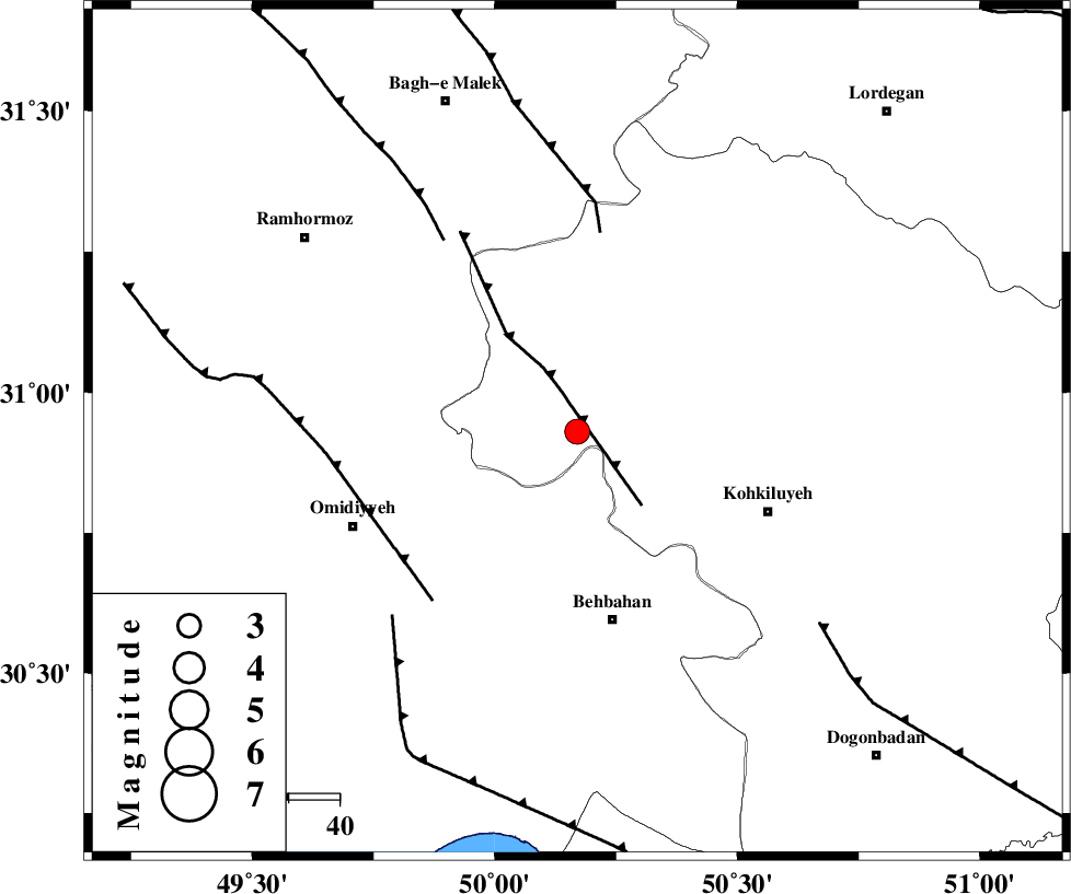
| Location | Lat:30.93 Lon: 50.17 |
| Region | Kohkiluieh va boyerahmad Province, 38 km North of Behbahan |
Nearest Cities |
|
| 24 km North of Dodange-ye bozorg, Khoozestan Province | |
| 25 km West of Lendeh, Kohkiluieh va boyerahmad Province | |
| 29 km North East of Jolaki, Khoozestan Province | |
| 31 km North East of Jayzan, Khoozestan Province | |
| 35 km North West of Mansuriyeh, Khoozestan Province | |
| Depth | 14 km |
| Agency | |
Faults within 150 km: |
|
| MFF4 (Length: 62 km) , Distance to epicenter: 8 km | |
| MFF2 (Length: 205 km) , Distance to epicenter: 40 km | |
| AGHAJARI_F (Length: 88 km) , Distance to epicenter: 44 km | |
| Number of Phases | 6 |
| RMS | 0.1 |
| Number of Stations | 4 |
| Error in Latitude | >4.2 km |
| Error in Longitude | 9.8 km |
| Error in Depth | 10.5 km |
Download waveform in seisan format
to download seisan software Click here
to access information about IIEES stations Click here
Amplitude | ||||||||
| UID | Agency | Station | Component | Amplitude | Period | Arrival Time | Proccessing Time | Signal Clip |
| 78807 | IIEES | SHGR | N | 360.9 | 0.4 | 2011-04-27 21:00:41 | 2011-04-28 02:40:00 | n |
| 78808 | IIEES | SHGR | E | 433.9 | 0.76 | 2011-04-27 21:00:44 | 2011-04-28 02:40:00 | n |
| 78809 | IIEES | GHIR | E | 36.4 | 0.84 | 2011-04-27 21:01:58 | 2011-04-28 02:40:00 | n |
Phase | ||||||||||||
| Agency | Station | Component | Phase Type | Phase Quality | First Motion | Observed Arrival Time | Time Residual | Loc. Flag | Input Weight | Distance | Azimuth | |
| IIEES | SHGR | Z | P | E | 2011-04-27 21:00:16 | 0.1 | y | 184 | 315 | |||
| IIEES | SHGR | N | Sg | E | 2011-04-27 21:00:38 | -0.1 | y | 184 | 315 | |||
| IIEES | AHRM | Z | P | E | 2011-04-27 21:00:25 | -0.1 | y | 253 | 154 | |||
| IIEES | GHIR | Z | P | E | 2011-04-27 21:00:43 | 0.1 | y | 400 | 136 | |||
| IIEES | ASAO | Z | P | E | 2011-04-27 21:00:43 | -0.1 | y | 401 | 358 | |||
| IIEES | ASAO | E | S | E | 2011-04-27 21:01:26 | 0 | y | 401 | 358 | |||