
Magnitude |
:2.9 |
| Date & Time (UTC) | 2011-04-20 16:20:35.6 |
| Date & Time (Local) | 1390/1/31 20:50:35.6 |
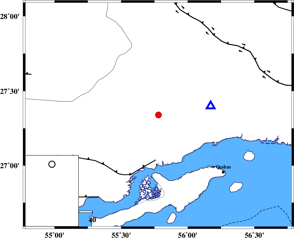
| Location | Lat:27.34 Lon: 55.78 |
| Region | Hormozgan Province, 53 km North-West of Bandar-e abbas |
Nearest Cities |
|
| 35 km South West of Fin, Hormozgan Province | |
| 47 km North East of Bandar-e khamir, Hormozgan Province | |
| 53 km North West of Bandar-e abbas, Hormozgan Province | |
| 64 km North West of Qeshm, Hormozgan Province | |
| 68 km South East of Darz, Fars Province | |
| Depth | 14 km |
| Agency | |
Faults within 150 km: |
|
| MFF1 (Length: 180 km) , Distance to epicenter: 34 km | |
| HZF2 (Length: 437 km) , Distance to epicenter: 72 km | |
| ZFF1 (Length: 165 km) , Distance to epicenter: 75 km | |
| Number of Phases | 5 |
| RMS | 0 |
| Number of Stations | 3 |
| Error in Latitude | >1.9 km |
| Error in Longitude | 1.1 km |
| Error in Depth | 3.2 km |
Download waveform in seisan format
to download seisan software Click here
to access information about IIEES stations Click here
Amplitude | ||||||||
| UID | Agency | Station | Component | Amplitude | Period | Arrival Time | Proccessing Time | Signal Clip |
| 78746 | IIEES | GHIR | N | 47.5 | 0.52 | 2011-04-20 16:22:14 | 2011-04-20 04:34:00 | n |
| 78747 | IIEES | GHIR | E | 50.5 | 0.75 | 2011-04-20 16:22:27 | 2011-04-20 04:34:00 | n |
| 78748 | IIEES | KRBR | E | 40.7 | 0.6 | 2011-04-20 16:22:07 | 2011-04-20 04:34:00 | n |
| 78749 | IIEES | KRBR | N | 39.4 | 0.44 | 2011-04-20 16:22:17 | 2011-04-20 04:34:00 | n |
Phase | ||||||||||||
| Agency | Station | Component | Phase Type | Phase Quality | First Motion | Observed Arrival Time | Time Residual | Loc. Flag | Input Weight | Distance | Azimuth | |
| IIEES | BNDS | Z | Pg | E | 2011-04-20 16:20:43 | 0 | y | 39.2 | 81 | |||
| IIEES | GHIR | Z | Pn | E | 2011-04-20 16:21:19 | 0 | y | 294 | 291 | |||
| IIEES | GHIR | E | Sg | E | 2011-04-20 16:21:58 | 0 | y | 294 | 291 | |||
| IIEES | KRBR | Z | Pn | E | 2011-04-20 16:21:21 | 0.1 | y | 308 | 18 | |||
| IIEES | KRBR | N | Sg | E | 2011-04-20 16:22:02 | 0 | y | 308 | 18 | |||