
Magnitude |
:4.5 |
| Date & Time (UTC) | 2011-04-13 03:37:09.5 |
| Date & Time (Local) | 1390/1/24 08:07:09.5 |
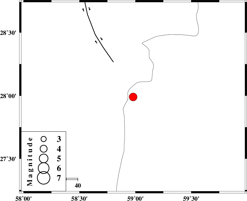
| Location | Lat:27.99 Lon: 58.98 |
| Region | Sistan va Baloochestan Province, 126 km East of Kahnuj |
Nearest Cities |
|
| 46 km East of Borj-e abbasabad, Kerman Province | |
| 74 km North West of Kalemursi, Sistan va Baloochestan Province | |
| 80 km South of Hoseynabad, Kerman Province | |
| 81 km South East of Mohammadabad-e gonbaki, Kerman Province | |
| 88 km South East of Mardehak, Kerman Province | |
| Depth | 18 km |
| Agency | |
Faults within 150 km: |
|
| BAM_F (Length: 118 km) , Distance to epicenter: 35 km | |
| JIROFT_F (Length: 144 km) , Distance to epicenter: 115 km | |
| S_JAZMURIAN_F (Length: 91 km) , Distance to epicenter: 122 km | |
| Number of Phases | 6 |
| RMS | 0.2 |
| Number of Stations | 5 |
| Error in Latitude | >6.2 km |
| Error in Longitude | 6.7 km |
| Error in Depth | 20.4 km |
Download waveform in seisan format
to download seisan software Click here
to access information about IIEES stations Click here
Amplitude | ||||||||
| UID | Agency | Station | Component | Amplitude | Period | Arrival Time | Proccessing Time | Signal Clip |
| 78702 | IIEES | BNDS | E | 2658.5 | 0.68 | 2011-04-13 03:38:32 | 2011-04-13 03:50:00 | n |
| 78703 | IIEES | BNDS | N | 4620.4 | 0.58 | 2011-04-13 03:38:37 | 2011-04-13 03:50:00 | n |
| 78704 | IIEES | CHBR | E | 772.5 | 1.3 | 2011-04-13 03:38:37 | 2011-04-13 03:50:00 | n |
| 78705 | IIEES | KRBR | E | 2026.3 | 0.78 | 2011-04-13 03:38:36 | 2011-04-13 03:50:00 | n |
| 78706 | IIEES | KRBR | N | 1501.7 | 0.78 | 2011-04-13 03:38:40 | 2011-04-13 03:50:00 | n |
Phase | ||||||||||||
| Agency | Station | Component | Phase Type | Phase Quality | First Motion | Observed Arrival Time | Time Residual | Loc. Flag | Input Weight | Distance | Azimuth | |
| IIEES | ZHSF | Z | Pg | E | 2011-04-13 03:37:50 | 0.4 | y | 251 | 44 | |||
| IIEES | ZHSF | E | Sg | E | 2011-04-13 03:38:20 | -0.1 | y | 251 | 44 | |||
| IIEES | BNDS | Z | Pn | E | 2011-04-13 03:37:52 | 0.2 | y | 284 | 257 | |||
| IIEES | CHBR | Z | Pn | E | 2011-04-13 03:37:54 | -0.2 | y | 305 | 150 | |||
| IIEES | KRBR | Z | Pn | E | 2011-04-13 03:37:55 | -0.3 | y | 309 | 316 | |||
| IIEES | GHIR | Z | Pn | E | 2011-04-13 03:38:30 | 0.1 | y | 589 | 275 | |||