
Magnitude |
:2.9 |
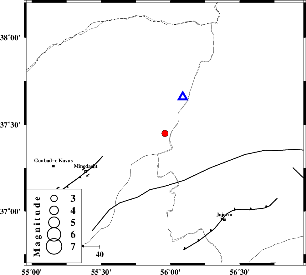
| Date & Time (UTC) | 2011-03-27 06:32:32.0 |
| Date & Time (Local) | 1390/1/7 11:02:32.0 |
| Location | Lat:37.45 Lon: 55.96 |
| Region | Golestan Province, 42 km East of Kalaleh |
Nearest Cities |
|
| 21 km South of Golidagh, Golestan Province | |
| 31 km East of Pashikmar, Golestan Province | |
| 31 km North East of Aq qamish, Golestan Province | |
| 35 km North East of Ajen sangarli, Golestan Province | |
| 40 km North East of Farsian, Golestan Province | |
| Depth | 11 km |
| Agency | |
Faults within 150 km: |
|
| ROBATE_QARABIL_F (Length: 168 km) , Distance to epicenter: 32 km | |
| JAJARAM_F (Length: 77 km) , Distance to epicenter: 65 km | |
| ESFARAYEN_F (Length: 111 km) , Distance to epicenter: 84 km | |
| Number of Phases | 5 |
| RMS | 0 |
| Number of Stations | 5 |
| Error in Latitude | >11 km |
| Error in Longitude | 4.7 km |
| Error in Depth | 16.6 km |
Download waveform in seisan format
to download seisan software Click here
to access information about IIEES stations Click here
Amplitude | ||||||||
| UID | Agency | Station | Component | Amplitude | Period | Arrival Time | Proccessing Time | Signal Clip |
| 78479 | IIEES | MRVT | N | 2418.2 | 0.35 | 2011-03-27 06:32:43 | 2011-03-27 06:52:00 | n |
| 78480 | IIEES | MRVT | E | 1791 | 0.19 | 2011-03-27 06:32:43 | 2011-03-27 06:52:00 | n |
Phase | ||||||||||||
| Agency | Station | Component | Phase Type | Phase Quality | First Motion | Observed Arrival Time | Time Residual | Loc. Flag | Input Weight | Distance | Azimuth | |
| IIEES | MRVT | Z | Pg | E | 2011-03-27 06:32:37 | 0 | y | 26.3 | 27 | |||
| IIEES | BJRD | Z | Pg | E | 2011-03-27 06:32:54 | 0 | y | 131 | 77 | |||
| IIEES | DAMV | Z | Pn | E | 2011-03-27 06:33:31 | 0 | y | 410 | 242 | |||
| IIEES | TABS | Z | Pn | E | 2011-03-27 06:33:34 | 0 | y | 434 | 166 | |||
| IIEES | SHRT | Z | Pn | E | 2011-03-27 06:33:51 | 0 | y | 576 | 136 | |||