
Magnitude |
:3.4 |
| Date & Time (UTC) | 2011-03-22 02:55:23.4 |
| Date & Time (Local) | 1390/1/2 07:25:23.4 |
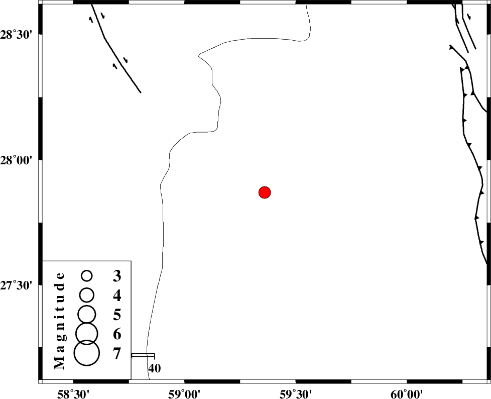
| Location | Lat:27.87 Lon: 59.36 |
| Region | Sistan va Baloochestan Province, 164 km East of Kahnuj |
Nearest Cities |
|
| 47 km North of Kalemursi, Sistan va Baloochestan Province | |
| 80 km North West of Bozman, Sistan va Baloochestan Province | |
| 83 km West of Kiman, Sistan va Baloochestan Province | |
| 85 km South East of Borj-e abbasabad, Kerman Province | |
| 97 km South East of Hoseynabad, Kerman Province | |
| Depth | 18 km |
| Agency | |
Faults within 150 km: |
|
| BAM_F (Length: 118 km) , Distance to epicenter: 70 km | |
| KASKIN_F (Length: 100 km) , Distance to epicenter: 92 km | |
| DAMAN_F (Length: 167 km) , Distance to epicenter: 102 km | |
| Number of Phases | 6 |
| RMS | 0.4 |
| Number of Stations | 5 |
| Error in Latitude | >7.6 km |
| Error in Longitude | 8.1 km |
| Error in Depth | 22.6 km |
Download waveform in seisan format
to download seisan software Click here
to access information about IIEES stations Click here
Amplitude | ||||||||
| UID | Agency | Station | Component | Amplitude | Period | Arrival Time | Proccessing Time | Signal Clip |
| 78402 | IIEES | BNDS | E | 149.7 | 0.58 | 2011-03-22 02:57:04 | 2011-03-22 03:25:00 | n |
| 78403 | IIEES | BNDS | N | 163.1 | 0.58 | 2011-03-22 02:57:06 | 2011-03-22 03:25:00 | n |
| 78404 | IIEES | KRBR | E | 74.7 | 0.48 | 2011-03-22 02:57:05 | 2011-03-22 03:25:00 | n |
| 78405 | IIEES | KRBR | N | 86.7 | 0.53 | 2011-03-22 02:57:11 | 2011-03-22 03:25:00 | n |
| 78406 | IIEES | GHIR | N | 12.6 | 0.72 | 2011-03-22 02:58:06 | 2011-03-22 03:25:00 | n |
Phase | ||||||||||||
| Agency | Station | Component | Phase Type | Phase Quality | First Motion | Observed Arrival Time | Time Residual | Loc. Flag | Input Weight | Distance | Azimuth | |
| IIEES | ZHSF | Z | Pn | E | 2011-03-22 02:56:00 | 0.4 | y | 238 | 35 | |||
| IIEES | CHBR | Z | Pn | E | 2011-03-22 02:56:04 | -0.2 | y | 275 | 156 | |||
| IIEES | BNDS | Z | Pn | E | 2011-03-22 02:56:10 | 0.2 | y | 319 | 261 | |||
| IIEES | BNDS | E | Sg | E | 2011-03-22 02:56:53 | 0.2 | y | 319 | 261 | |||
| IIEES | KRBR | Z | Pn | E | 2011-03-22 02:56:13 | -0.8 | y | 345 | 313 | |||
| IIEES | GHIR | Z | Pn | E | 2011-03-22 02:56:48 | 0.1 | y | 628 | 276 | |||