
Magnitude |
:3.6 |
| Date & Time (UTC) | 2011-03-02 23:19:14.6 |
| Date & Time (Local) | 1389/12/12 02:49:14.6 |
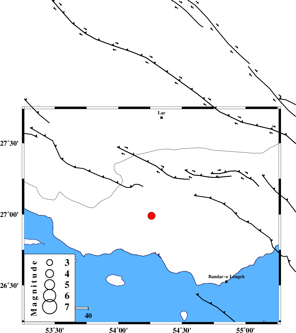
| Location | Lat:26.99 Lon: 54.26 |
| Region | Hormozgan Province, 26 km South-West of Bastak |
Nearest Cities |
|
| 4 km of Jenah, Hormozgan Province | |
| 25 km South West of Bastak, Hormozgan Province | |
| 56 km South East of Ahl, Fars Province | |
| 61 km South East of Bagh, Fars Province | |
| 69 km South East of Ashkenan, Fars Province | |
| Depth | 18 km |
| Agency | |
Faults within 150 km: |
|
| MFF1 (Length: 180 km) , Distance to epicenter: 10 km | |
| MFF3 (Length: 292 km) , Distance to epicenter: 18 km | |
| ZFF1 (Length: 165 km) , Distance to epicenter: 25 km | |
| Number of Phases | 4 |
| RMS | 0 |
| Number of Stations | 3 |
| Error in Latitude | >9.1 km |
| Error in Longitude | 3.7 km |
| Error in Depth | 8 km |
Download waveform in seisan format
to download seisan software Click here
to access information about IIEES stations Click here
Amplitude | ||||||||
| UID | Agency | Station | Component | Amplitude | Period | Arrival Time | Proccessing Time | Signal Clip |
| 78192 | IIEES | GHIR | E | 752.4 | 0.4 | 2011-03-02 23:20:09 | 2011-03-02 11:30:00 | n |
| 78193 | IIEES | GHIR | N | 862.6 | 0.44 | 2011-03-02 23:20:10 | 2011-03-02 11:30:00 | n |
| 78194 | IIEES | KRBR | N | 83 | 0.28 | 2011-03-02 23:20:56 | 2011-03-02 11:30:00 | n |
| 78195 | IIEES | KRBR | E | 74 | 0.84 | 2011-03-02 23:20:59 | 2011-03-02 11:30:00 | n |
Phase | ||||||||||||
| Agency | Station | Component | Phase Type | Phase Quality | First Motion | Observed Arrival Time | Time Residual | Loc. Flag | Input Weight | Distance | Azimuth | |
| IIEES | GHIR | Z | Pn | E | 2011-03-02 23:19:45 | 0.1 | y | 191 | 319 | |||
| IIEES | BNDS | Z | Pn | E | 2011-03-02 23:19:46 | 0 | y | 195 | 76 | |||
| IIEES | BNDS | E | Sg | E | 2011-03-02 23:20:10 | 0 | y | 195 | 76 | |||
| IIEES | KRBR | Z | Pn | E | 2011-03-02 23:20:13 | -0.1 | y | 412 | 36 | |||