
Magnitude |
:2.9 |
| Date & Time (UTC) | 2011-03-01 15:42:09.3 |
| Date & Time (Local) | 1389/12/10 19:12:09.3 |
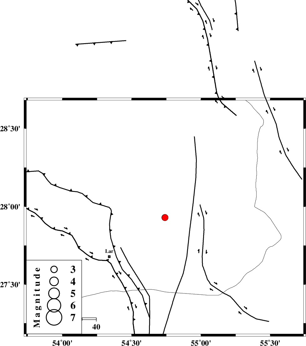
| Location | Lat:27.93 Lon: 54.74 |
| Region | Fars Province, 48 km North-East of Lar |
Nearest Cities |
|
| 32 km North East of Dehkuyeh, Fars Province | |
| 44 km North East of Latifi, Fars Province | |
| 48 km North East of Lar, Fars Province | |
| 53 km South West of Fadami, Fars Province | |
| 57 km South East of Hajiabad, Fars Province | |
| Depth | 15 km |
| Agency | |
Faults within 150 km: |
|
| LAR_F (Length: 99 km) , Distance to epicenter: 35 km | |
| BERIZ_F (Length: 49 km) , Distance to epicenter: 36 km | |
| HZF2 (Length: 437 km) , Distance to epicenter: 44 km | |
| Number of Phases | 3 |
| RMS | 0 |
| Number of Stations | 3 |
| Error in Latitude | >2.9 km |
| Error in Longitude | 1.6 km |
| Error in Depth | 0 km |
Download waveform in seisan format
to download seisan software Click here
to access information about IIEES stations Click here
Amplitude | ||||||||
| UID | Agency | Station | Component | Amplitude | Period | Arrival Time | Proccessing Time | Signal Clip |
| 78180 | IIEES | BNDS | N | 124.5 | 0.78 | 2011-03-01 15:43:02 | 2011-03-01 04:05:00 | n |
| 78181 | IIEES | BNDS | E | 123.1 | 0.47 | 2011-03-01 15:43:08 | 2011-03-01 04:05:00 | n |
| 78182 | IIEES | GHIR | N | 138.4 | 0.84 | 2011-03-01 15:43:09 | 2011-03-01 04:05:00 | n |
| 78183 | IIEES | GHIR | E | 122.4 | 1.47 | 2011-03-01 15:43:09 | 2011-03-01 04:05:00 | n |
| 78184 | IIEES | KRBR | N | 45.2 | 0.86 | 2011-03-01 15:43:38 | 2011-03-01 04:05:00 | n |
| 78185 | IIEES | KRBR | E | 80.8 | 0.43 | 2011-03-01 15:43:43 | 2011-03-01 04:05:00 | n |
Phase | ||||||||||||
| Agency | Station | Component | Phase Type | Phase Quality | First Motion | Observed Arrival Time | Time Residual | Loc. Flag | Input Weight | Distance | Azimuth | |
| IIEES | BNDS | Z | Pg | E | 2011-03-01 15:42:34 | 0 | y | 152 | 112 | |||
| IIEES | GHIR | Z | Pg | E | 2011-03-01 15:42:38 | 0 | y | 177 | 283 | |||
| IIEES | KRBR | Z | Pn | E | 2011-03-01 15:42:54 | 0 | y | 301 | 40 | |||