
Magnitude |
:3.5 |
| Date & Time (UTC) | 2011-02-05 16:20:10.1 |
| Date & Time (Local) | 1389/11/16 19:50:10.1 |
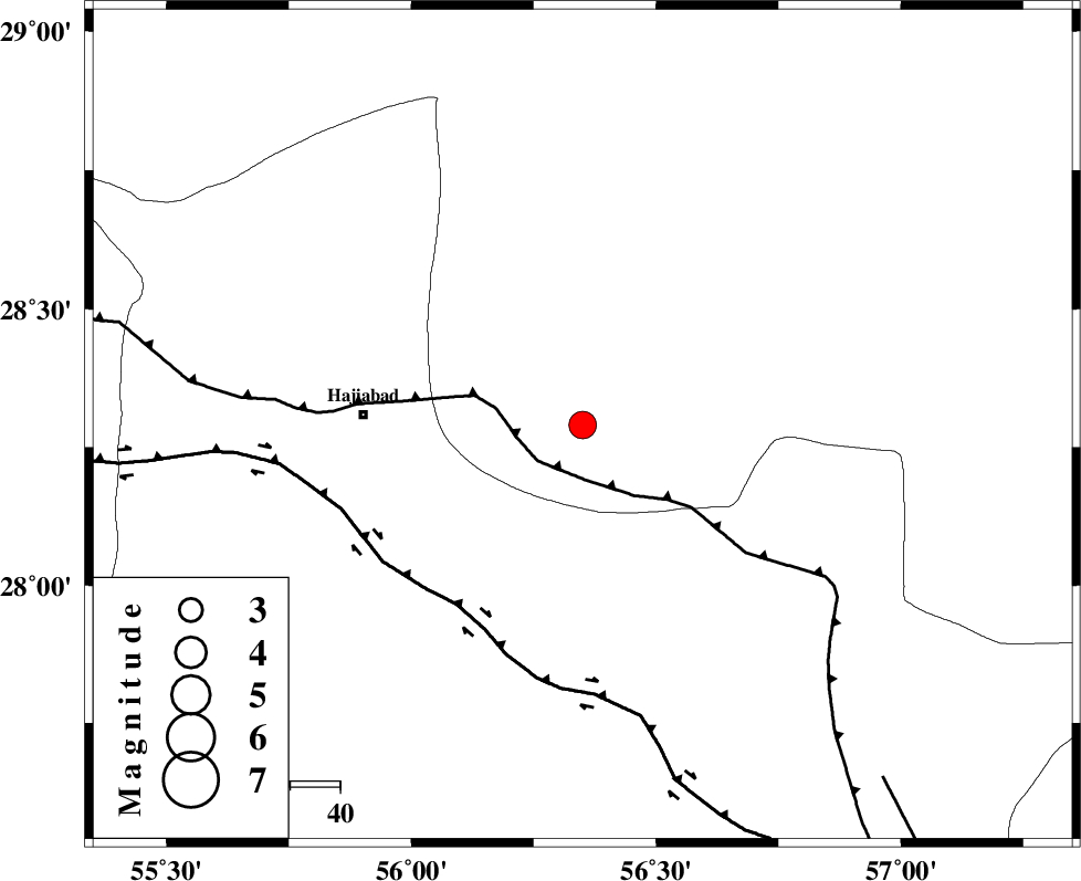
| Location | Lat:28.29 Lon: 56.35 |
| Region | Kerman Province, 44 km East of Hajiabad |
Nearest Cities |
|
| 17 km South of Arzuieeh, Kerman Province | |
| 19 km South of Shahmaran, Kerman Province | |
| 33 km North East of Fareqan, Hormozgan Province | |
| 44 km East of Hajiabad, Hormozgan Province | |
| 52 km West of Sarkhan, Kerman Province | |
| Depth | 14 km |
| Agency | |
Faults within 150 km: |
|
| MAIN_ZAGROS_R_F (Length: 1106 km) , Distance to epicenter: 11 km | |
| HZF2 (Length: 437 km) , Distance to epicenter: 44 km | |
| ZENDAN_MINAB_F_Z1 (Length: 183 km) , Distance to epicenter: 93 km | |
| Number of Phases | 4 |
| RMS | 0 |
| Number of Stations | 3 |
| Error in Latitude | >5.4 km |
| Error in Longitude | 6.6 km |
| Error in Depth | 13 km |
Download waveform in seisan format
to download seisan software Click here
to access information about IIEES stations Click here
Amplitude | ||||||||
| UID | Agency | Station | Component | Amplitude | Period | Arrival Time | Proccessing Time | Signal Clip |
| 77808 | IIEES | BNDS | E | 2489.4 | 0.38 | 2011-02-05 16:20:44 | 2011-02-05 04:44:00 | n |
| 77809 | IIEES | BNDS | N | 1415.2 | 0.66 | 2011-02-05 16:20:45 | 2011-02-05 04:44:00 | n |
| 77810 | IIEES | KRBR | N | 338.2 | 0.84 | 2011-02-05 16:21:14 | 2011-02-05 04:44:00 | n |
| 77811 | IIEES | KRBR | E | 350.4 | 1.2 | 2011-02-05 16:21:15 | 2011-02-05 04:44:00 | n |
Phase | ||||||||||||
| Agency | Station | Component | Phase Type | Phase Quality | First Motion | Observed Arrival Time | Time Residual | Loc. Flag | Input Weight | Distance | Azimuth | |
| IIEES | BNDS | Z | Pg | E | 2011-02-05 16:20:27 | 0 | y | 101 | 190 | |||
| IIEES | BNDS | E | Sg | E | 2011-02-05 16:20:40 | 0 | y | 101 | 190 | |||
| IIEES | KRBR | Z | Pn | E | 2011-02-05 16:20:42 | 0 | y | 191 | 12 | |||
| IIEES | GHIR | Z | Pn | E | 2011-02-05 16:20:59 | 0 | y | 330 | 271 | |||