
Magnitude |
:3.5 |
| Date & Time (UTC) | 2011-01-31 05:39:31.5 |
| Date & Time (Local) | 1389/11/11 09:09:31.5 |
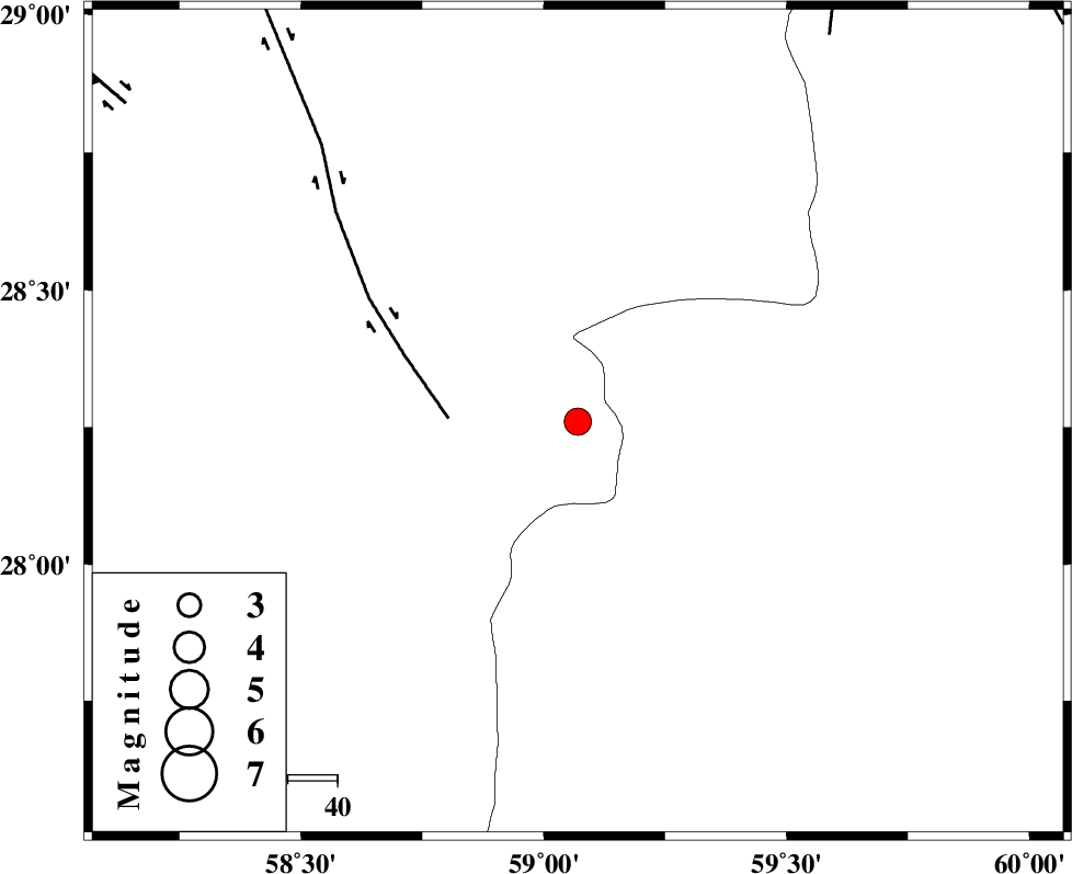
| Location | Lat:28.26 Lon: 59.07 |
| Region | Kerman Province, 118 km South-East of Bam |
Nearest Cities |
|
| 49 km South of Hoseynabad, Kerman Province | |
| 54 km South East of Mohammadabad-e gonbaki, Kerman Province | |
| 60 km North East of Borj-e abbasabad, Kerman Province | |
| 70 km South East of Void, Kerman Province | |
| 80 km South East of Fahroj, Kerman Province | |
| Depth | 16 km |
| Agency | |
Faults within 150 km: |
|
| BAM_F (Length: 118 km) , Distance to epicenter: 26 km | |
| KANURAK_F (Length: 135 km) , Distance to epicenter: 93 km | |
| GOWK_F (Length: 152 km) , Distance to epicenter: 111 km | |
| Number of Phases | 5 |
| RMS | 0.2 |
| Number of Stations | 4 |
| Error in Latitude | >6.4 km |
| Error in Longitude | 3.6 km |
| Error in Depth | 9.7 km |
Download waveform in seisan format
to download seisan software Click here
to access information about IIEES stations Click here
Amplitude | ||||||||
| UID | Agency | Station | Component | Amplitude | Period | Arrival Time | Proccessing Time | Signal Clip |
| 77708 | IIEES | KRBR | N | 179.8 | 0.49 | 2011-01-31 05:40:56 | 2011-01-31 05:50:00 | n |
| 77709 | IIEES | BNDS | E | 148.5 | 0.57 | 2011-01-31 05:40:55 | 2011-01-31 05:50:00 | n |
| 77710 | IIEES | BNDS | N | 225.8 | 0.5 | 2011-01-31 05:40:57 | 2011-01-31 05:50:00 | n |
Phase | ||||||||||||
| Agency | Station | Component | Phase Type | Phase Quality | First Motion | Observed Arrival Time | Time Residual | Loc. Flag | Input Weight | Distance | Azimuth | |
| IIEES | ZHSF | Z | Pg | E | 2011-01-31 05:40:08 | 0 | y | 224 | 47 | |||
| IIEES | KRBR | Z | Pn | E | 2011-01-31 05:40:16 | 0.3 | y | 296 | 311 | |||
| IIEES | KRBR | N | Sg | E | 2011-01-31 05:40:54 | 0 | y | 296 | 311 | |||
| IIEES | BNDS | Z | Pn | E | 2011-01-31 05:40:16 | -0.1 | y | 301 | 252 | |||
| IIEES | TABS | Z | Pn | E | 2011-01-31 05:40:56 | -0.4 | y | 627 | 343 | |||