
Magnitude |
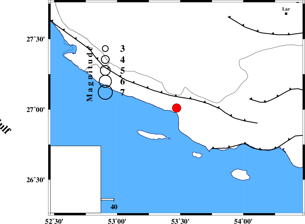
:4.4 |
| Date & Time (UTC) | 2011-01-30 18:58:13.8 |
| Date & Time (Local) | 1389/11/10 22:28:13.8 |
| Location | Lat:27.01 Lon: 53.47 |
| Region | Hormozgan Province, 46 km South-East of Lamerd |
Nearest Cities |
|
| 27 km South West of Ashkenan, Fars Province | |
| 32 km South West of Ahl, Fars Province | |
| 46 km South of Beyram, Fars Province | |
| 47 km South East of Lamerd, Fars Province | |
| 64 km South of Fedagh, Fars Province | |
| Depth | 18 km |
| Agency | |
Faults within 150 km: |
|
| MFF3 (Length: 292 km) , Distance to epicenter: 11 km | |
| ZFF1 (Length: 165 km) , Distance to epicenter: 42 km | |
| MFF1 (Length: 180 km) , Distance to epicenter: 58 km | |
| Number of Phases | 5 |
| RMS | 0 |
| Number of Stations | 4 |
| Error in Latitude | >4.1 km |
| Error in Longitude | 2.7 km |
| Error in Depth | 5.6 km |
Download waveform in seisan format
to download seisan software Click here
to access information about IIEES stations Click here
Amplitude | ||||||||
| UID | Agency | Station | Component | Amplitude | Period | Arrival Time | Proccessing Time | Signal Clip |
| 77684 | IIEES | GHIR | E | 8305.1 | 0.56 | 2011-01-30 18:58:57 | 2011-01-30 07:19:00 | n |
| 77685 | IIEES | GHIR | N | 6752.8 | 0.64 | 2011-01-30 18:59:00 | 2011-01-30 07:19:00 | n |
| 77686 | IIEES | AHRM | E | 1326.2 | 0.56 | 2011-01-30 18:59:52 | 2011-01-30 07:19:00 | n |
| 77687 | IIEES | AHRM | N | 1964.1 | 0.72 | 2011-01-30 18:59:58 | 2011-01-30 07:19:00 | n |
| 77688 | IIEES | KRBR | N | 234.2 | 0.6 | 2011-01-30 19:00:32 | 2011-01-30 07:19:00 | n |
Phase | ||||||||||||
| Agency | Station | Component | Phase Type | Phase Quality | First Motion | Observed Arrival Time | Time Residual | Loc. Flag | Input Weight | Distance | Azimuth | |
| IIEES | GHIR | Z | Pg | E | 2011-01-30 18:58:38 | 0 | y | 149 | 342 | |||
| IIEES | GHIR | E | Sg | E | 2011-01-30 18:58:56 | 0 | y | 149 | 342 | |||
| IIEES | BNDS | Z | Pn | E | 2011-01-30 18:58:54 | 0 | y | 272 | 80 | |||
| IIEES | AHRM | Z | Pn | E | 2011-01-30 18:58:57 | 0 | y | 296 | 314 | |||
| IIEES | KRBR | Z | Pn | E | 2011-01-30 18:59:18 | 0 | y | 461 | 44 | |||