
Magnitude |
:3.1 |
| Date & Time (UTC) | 2011-01-28 20:30:19.0 |
| Date & Time (Local) | 1389/11/9 00:00:19.0 |
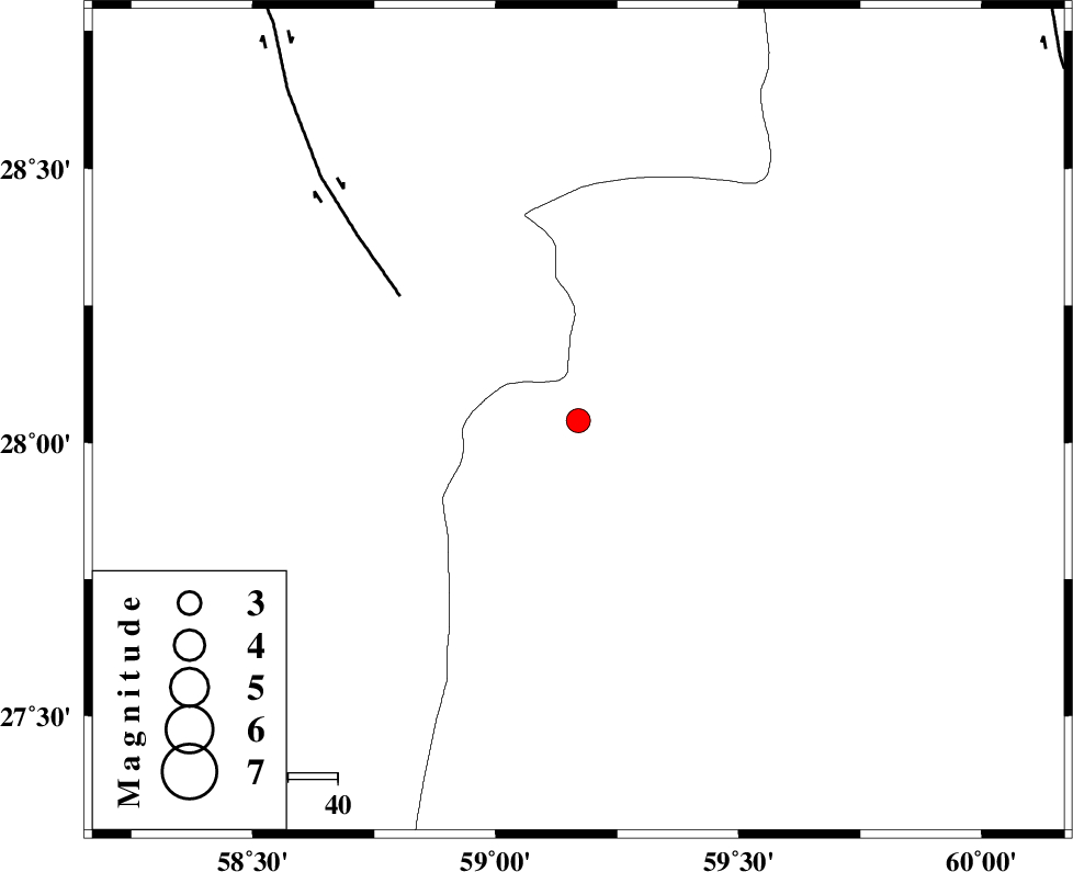
| Location | Lat:28.04 Lon: 59.17 |
| Region | Sistan va Baloochestan Province, 145 km East of Kahnuj |
Nearest Cities |
|
| 64 km North East of Borj-e abbasabad, Kerman Province | |
| 70 km North West of Kalemursi, Sistan va Baloochestan Province | |
| 74 km South East of Hoseynabad, Kerman Province | |
| 81 km South East of Mohammadabad-e gonbaki, Kerman Province | |
| 96 km South East of Void, Kerman Province | |
| Depth | 14 km |
| Agency | |
Faults within 150 km: |
|
| BAM_F (Length: 118 km) , Distance to epicenter: 44 km | |
| KASKIN_F (Length: 100 km) , Distance to epicenter: 107 km | |
| DAMAN_F (Length: 167 km) , Distance to epicenter: 110 km | |
| Number of Phases | 5 |
| RMS | 0.1 |
| Number of Stations | 3 |
| Error in Latitude | >5.8 km |
| Error in Longitude | 3.9 km |
| Error in Depth | 4.2 km |
Download waveform in seisan format
to download seisan software Click here
to access information about IIEES stations Click here
Amplitude | ||||||||
| UID | Agency | Station | Component | Amplitude | Period | Arrival Time | Proccessing Time | Signal Clip |
| 77625 | IIEES | BNDS | N | 65.6 | 0.56 | 2011-01-28 20:31:51 | 2011-01-28 08:46:00 | n |
| 77626 | IIEES | BNDS | E | 69 | 0.4 | 2011-01-28 20:31:51 | 2011-01-28 08:46:00 | n |
| 77627 | IIEES | KRBR | N | 54.4 | 0.68 | 2011-01-28 20:31:49 | 2011-01-28 08:46:00 | n |
| 77628 | IIEES | KRBR | E | 60.7 | 0.36 | 2011-01-28 20:31:53 | 2011-01-28 08:46:00 | n |
Phase | ||||||||||||
| Agency | Station | Component | Phase Type | Phase Quality | First Motion | Observed Arrival Time | Time Residual | Loc. Flag | Input Weight | Distance | Azimuth | |
| IIEES | ZHSF | Z | Pn | E | 2011-01-28 20:30:55 | -0.1 | y | 234 | 42 | |||
| IIEES | ZHSF | E | Sg | E | 2011-01-28 20:31:25 | 0 | y | 234 | 42 | |||
| IIEES | BNDS | N | Pn | E | 2011-01-28 20:31:04 | 0.1 | y | 304 | 257 | |||
| IIEES | BNDS | E | Sg | E | 2011-01-28 20:31:44 | -0.1 | y | 304 | 257 | |||
| IIEES | KRBR | Z | Pn | E | 2011-01-28 20:31:06 | 0 | y | 319 | 313 | |||