
Magnitude |
:3.2 |
| Date & Time (UTC) | 2011-01-28 06:43:41.9 |
| Date & Time (Local) | 1389/11/8 10:13:41.9 |
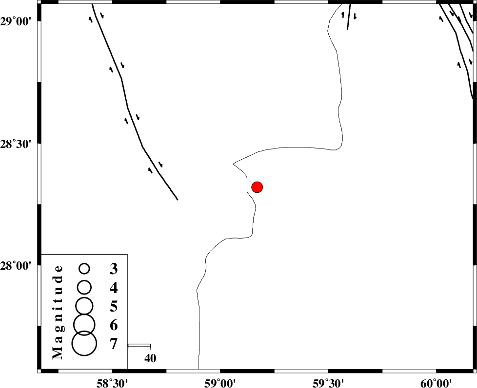
| Location | Lat:28.32 Lon: 59.17 |
| Region | Sistan va Baloochestan Province, 118 km South-East of Bam |
Nearest Cities |
|
| 44 km South East of Hoseynabad, Kerman Province | |
| 53 km South East of Mohammadabad-e gonbaki, Kerman Province | |
| 67 km South East of Void, Kerman Province | |
| 72 km North East of Borj-e abbasabad, Kerman Province | |
| 76 km South East of Fahroj, Kerman Province | |
| Depth | 40 km |
| Agency | |
Faults within 150 km: |
|
| BAM_F (Length: 118 km) , Distance to epicenter: 36 km | |
| KANURAK_F (Length: 135 km) , Distance to epicenter: 82 km | |
| DAMAN_F (Length: 167 km) , Distance to epicenter: 101 km | |
| Number of Phases | 4 |
| RMS | 0 |
| Number of Stations | 3 |
| Error in Latitude | >4.5 km |
| Error in Longitude | 3 km |
| Error in Depth | 5.3 km |
Download waveform in seisan format
to download seisan software Click here
to access information about IIEES stations Click here
Amplitude | ||||||||
| UID | Agency | Station | Component | Amplitude | Period | Arrival Time | Proccessing Time | Signal Clip |
| 77574 | IIEES | KRBR | E | 75.1 | 0.86 | 2011-01-28 06:45:04 | 2011-01-28 06:55:00 | n |
| 77575 | IIEES | KRBR | N | 87.5 | 0.97 | 2011-01-28 06:45:05 | 2011-01-28 06:55:00 | n |
| 77576 | IIEES | BNDS | N | 130.9 | 0.51 | 2011-01-28 06:45:05 | 2011-01-28 06:55:00 | n |
| 77577 | IIEES | BNDS | E | 105 | 0.34 | 2011-01-28 06:45:06 | 2011-01-28 06:55:00 | n |
Phase | ||||||||||||
| Agency | Station | Component | Phase Type | Phase Quality | First Motion | Observed Arrival Time | Time Residual | Loc. Flag | Input Weight | Distance | Azimuth | |
| IIEES | ZHSF | Z | P | E | 2011-01-28 06:44:13 | 0 | y | 212 | 47 | |||
| IIEES | ZHSF | N | Sg | E | 2011-01-28 06:44:41 | 0 | y | 212 | 47 | |||
| IIEES | KRBR | Z | Pn | E | 2011-01-28 06:44:24 | 0 | y | 298 | 309 | |||
| IIEES | BNDS | Z | Pn | E | 2011-01-28 06:44:26 | 0 | y | 312 | 252 | |||