
Magnitude |
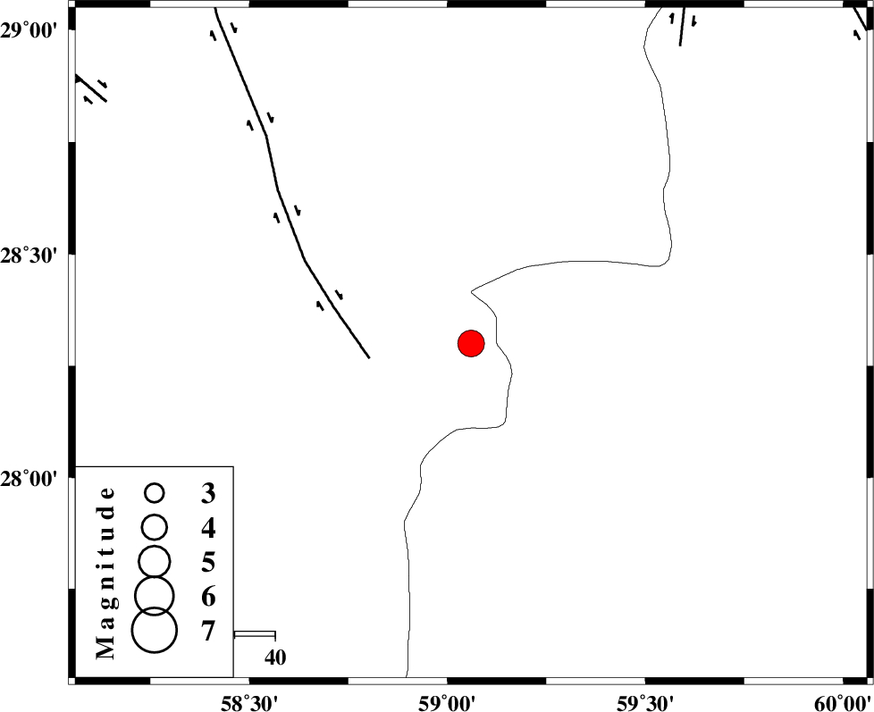
:4.2 |
| Date & Time (UTC) | 2011-01-28 06:34:00.8 |
| Date & Time (Local) | 1389/11/8 10:04:00.8 |
| Location | Lat:28.3 Lon: 59.06 |
| Region | Kerman Province, 113 km South-East of Bam |
Nearest Cities |
|
| 45 km South of Hoseynabad, Kerman Province | |
| 50 km South East of Mohammadabad-e gonbaki, Kerman Province | |
| 62 km North East of Borj-e abbasabad, Kerman Province | |
| 65 km South East of Void, Kerman Province | |
| 75 km South East of Fahroj, Kerman Province | |
| Depth | 18 km |
| Agency | |
Faults within 150 km: |
|
| BAM_F (Length: 118 km) , Distance to epicenter: 25 km | |
| KANURAK_F (Length: 135 km) , Distance to epicenter: 90 km | |
| GOWK_F (Length: 152 km) , Distance to epicenter: 108 km | |
| Number of Phases | 5 |
| RMS | 0.2 |
| Number of Stations | 3 |
| Error in Latitude | >7 km |
| Error in Longitude | 2.3 km |
| Error in Depth | 10.7 km |
Download waveform in seisan format
to download seisan software Click here
to access information about IIEES stations Click here
Amplitude | ||||||||
| UID | Agency | Station | Component | Amplitude | Period | Arrival Time | Proccessing Time | Signal Clip |
| 77570 | IIEES | KRBR | N | 767.7 | 1.18 | 2011-01-28 06:35:31 | 2011-01-28 06:44:00 | n |
| 77571 | IIEES | KRBR | E | 653.3 | 2.56 | 2011-01-28 06:35:32 | 2011-01-28 06:44:00 | n |
| 77572 | IIEES | BNDS | N | 1165.2 | 1.17 | 2011-01-28 06:35:31 | 2011-01-28 06:44:00 | n |
| 77573 | IIEES | BNDS | E | 1072.9 | 2.05 | 2011-01-28 06:35:34 | 2011-01-28 06:44:00 | n |
Phase | ||||||||||||
| Agency | Station | Component | Phase Type | Phase Quality | First Motion | Observed Arrival Time | Time Residual | Loc. Flag | Input Weight | Distance | Azimuth | |
| IIEES | ZHSF | Z | Pn | E | 2011-01-28 06:34:35 | -0.3 | y | 221 | 49 | |||
| IIEES | ZHSF | E | Sg | E | 2011-01-28 06:35:03 | 0.1 | y | 221 | 49 | |||
| IIEES | KRBR | Z | Pn | E | 2011-01-28 06:34:44 | 0.2 | y | 291 | 310 | |||
| IIEES | KRBR | E | Sg | E | 2011-01-28 06:35:22 | -0.1 | y | 291 | 310 | |||
| IIEES | BNDS | Z | Pn | E | 2011-01-28 06:34:45 | 0 | y | 301 | 251 | |||