
Magnitude |
:3.3 |
| Date & Time (UTC) | 2011-01-28 06:14:29.4 |
| Date & Time (Local) | 1389/11/8 09:44:29.4 |
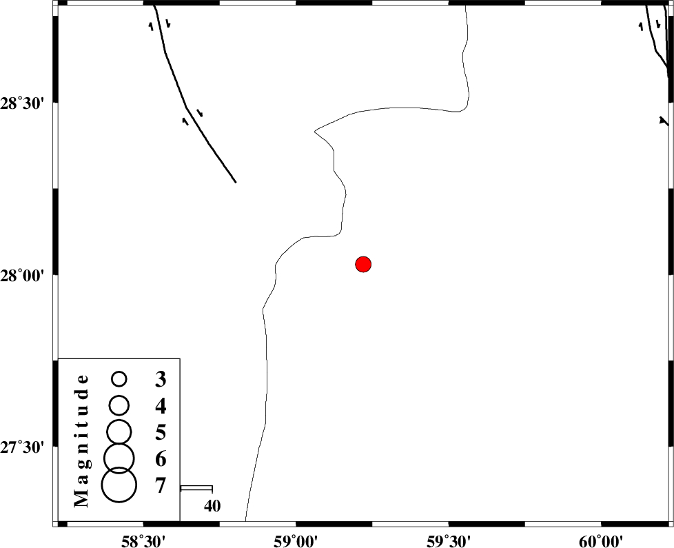
| Location | Lat:28.03 Lon: 59.22 |
| Region | Sistan va Baloochestan Province, 150 km East of Kahnuj |
Nearest Cities |
|
| 67 km North West of Kalemursi, Sistan va Baloochestan Province | |
| 69 km North East of Borj-e abbasabad, Kerman Province | |
| 76 km South East of Hoseynabad, Kerman Province | |
| 84 km South East of Mohammadabad-e gonbaki, Kerman Province | |
| 96 km North West of Bozman, Sistan va Baloochestan Province | |
| Depth | 14 km |
| Agency | |
Faults within 150 km: |
|
| BAM_F (Length: 118 km) , Distance to epicenter: 49 km | |
| KASKIN_F (Length: 100 km) , Distance to epicenter: 102 km | |
| DAMAN_F (Length: 167 km) , Distance to epicenter: 106 km | |
| Number of Phases | 4 |
| RMS | 0 |
| Number of Stations | 3 |
| Error in Latitude | >7.2 km |
| Error in Longitude | 13.9 km |
| Error in Depth | 22.9 km |
Download waveform in seisan format
to download seisan software Click here
to access information about IIEES stations Click here
Amplitude | ||||||||
| UID | Agency | Station | Component | Amplitude | Period | Arrival Time | Proccessing Time | Signal Clip |
| 77566 | IIEES | BNDS | E | 93 | 1.3 | 2011-01-28 06:15:53 | 2011-01-28 06:26:00 | n |
| 77567 | IIEES | BNDS | N | 79.3 | 0 | 2011-01-28 06:15:58 | 2011-01-28 06:26:00 | n |
| 77568 | IIEES | KRBR | E | 100.5 | 0 | 2011-01-28 06:15:56 | 2011-01-28 06:26:00 | n |
| 77569 | IIEES | KRBR | N | 108.7 | 0.2 | 2011-01-28 06:15:57 | 2011-01-28 06:26:00 | n |
Phase | ||||||||||||
| Agency | Station | Component | Phase Type | Phase Quality | First Motion | Observed Arrival Time | Time Residual | Loc. Flag | Input Weight | Distance | Azimuth | |
| IIEES | ZHSF | Z | Pg | E | 2011-01-28 06:15:07 | 0 | y | 232 | 40 | |||
| IIEES | ZHSF | N | Sg | E | 2011-01-28 06:15:35 | 0 | y | 232 | 40 | |||
| IIEES | BNDS | Z | Pn | E | 2011-01-28 06:15:15 | 0 | y | 309 | 258 | |||
| IIEES | KRBR | Z | Pn | E | 2011-01-28 06:15:17 | 0 | y | 323 | 313 | |||