
Magnitude |
:2.9 |
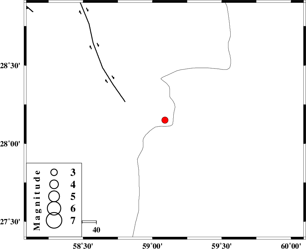
| Date & Time (UTC) | 2011-01-27 21:41:33.6 |
| Date & Time (Local) | 1389/11/8 01:11:33.6 |
| Location | Lat:28.15 Lon: 59.09 |
| Region | Kerman Province, 139 km North-East of Kahnuj |
Nearest Cities |
|
| 58 km North East of Borj-e abbasabad, Kerman Province | |
| 62 km South of Hoseynabad, Kerman Province | |
| 66 km South East of Mohammadabad-e gonbaki, Kerman Province | |
| 82 km South East of Void, Kerman Province | |
| 84 km North West of Kalemursi, Sistan va Baloochestan Province | |
| Depth | 14 km |
| Agency | |
Faults within 150 km: |
|
| BAM_F (Length: 118 km) , Distance to epicenter: 31 km | |
| KANURAK_F (Length: 135 km) , Distance to epicenter: 103 km | |
| DAMAN_F (Length: 167 km) , Distance to epicenter: 113 km | |
| Number of Phases | 5 |
| RMS | 0.2 |
| Number of Stations | 3 |
| Error in Latitude | >8.7 km |
| Error in Longitude | 5.8 km |
| Error in Depth | 6.5 km |
Download waveform in seisan format
to download seisan software Click here
to access information about IIEES stations Click here
Amplitude | ||||||||
| UID | Agency | Station | Component | Amplitude | Period | Arrival Time | Proccessing Time | Signal Clip |
| 77502 | IIEES | BNDS | E | 55.8 | 0.36 | 2011-01-27 21:43:00 | 2011-01-28 12:14:00 | n |
| 77503 | IIEES | BNDS | N | 45.8 | 0.4 | 2011-01-27 21:43:06 | 2011-01-28 12:14:00 | n |
| 77504 | IIEES | KRBR | E | 42.7 | 0.2 | 2011-01-27 21:43:01 | 2011-01-28 12:14:00 | n |
| 77505 | IIEES | KRBR | N | 53.5 | 0.72 | 2011-01-27 21:43:04 | 2011-01-28 12:14:00 | n |
Phase | ||||||||||||
| Agency | Station | Component | Phase Type | Phase Quality | First Motion | Observed Arrival Time | Time Residual | Loc. Flag | Input Weight | Distance | Azimuth | |
| IIEES | ZHSF | Z | Pn | E | 2011-01-27 21:42:10 | 0 | y | 231 | 45 | |||
| IIEES | ZHSF | E | Sg | E | 2011-01-27 21:42:38 | -0.1 | y | 231 | 45 | |||
| IIEES | BNDS | E | Pn | E | 2011-01-27 21:42:18 | 0.2 | y | 299 | 255 | |||
| IIEES | BNDS | E | Sg | E | 2011-01-27 21:42:57 | -0.3 | y | 299 | 255 | |||
| IIEES | KRBR | Z | Pn | E | 2011-01-27 21:42:19 | 0.2 | y | 304 | 312 | |||