
Magnitude |
:3.3 |
| Date & Time (UTC) | 2011-01-27 16:31:54.7 |
| Date & Time (Local) | 1389/11/7 20:01:54.7 |
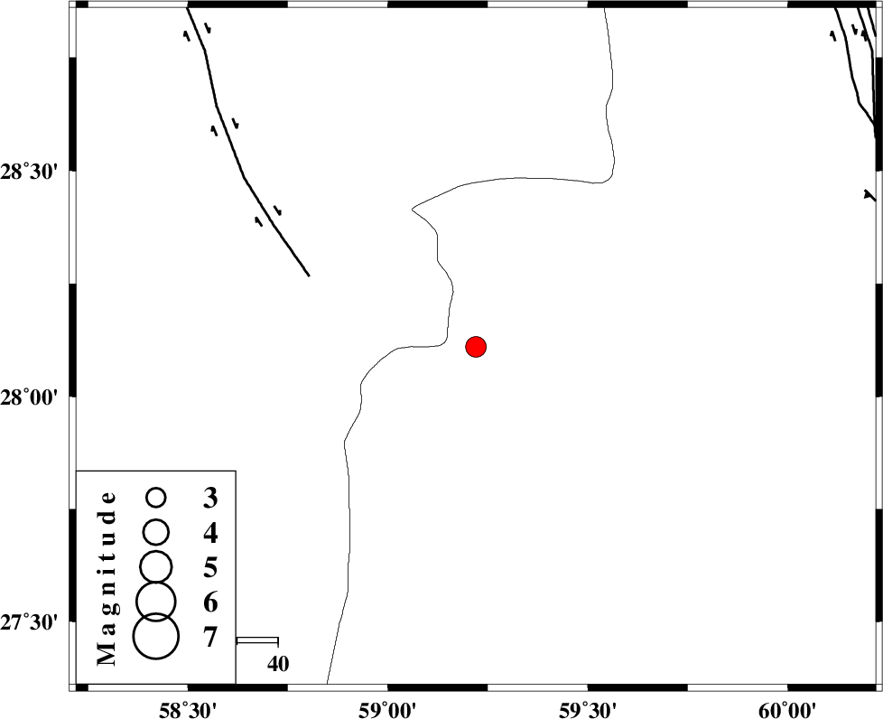
| Location | Lat:28.11 Lon: 59.22 |
| Region | Sistan va Baloochestan Province, 151 km North-East of Kahnuj |
Nearest Cities |
|
| 68 km South East of Hoseynabad, Kerman Province | |
| 70 km North East of Borj-e abbasabad, Kerman Province | |
| 76 km South East of Mohammadabad-e gonbaki, Kerman Province | |
| 76 km North West of Kalemursi, Sistan va Baloochestan Province | |
| 90 km South East of Void, Kerman Province | |
| Depth | 15 km |
| Agency | |
Faults within 150 km: |
|
| BAM_F (Length: 118 km) , Distance to epicenter: 44 km | |
| KASKIN_F (Length: 100 km) , Distance to epicenter: 101 km | |
| KANURAK_F (Length: 135 km) , Distance to epicenter: 102 km | |
| Number of Phases | 4 |
| RMS | 0.1 |
| Number of Stations | 4 |
| Error in Latitude | >2 km |
| Error in Longitude | 1.5 km |
| Error in Depth | 0 km |
Download waveform in seisan format
to download seisan software Click here
to access information about IIEES stations Click here
Amplitude | ||||||||
| UID | Agency | Station | Component | Amplitude | Period | Arrival Time | Proccessing Time | Signal Clip |
| 77454 | IIEES | BNDS | N | 128.6 | 0.48 | 2011-01-27 16:33:23 | 2011-01-27 04:41:00 | n |
| 77455 | IIEES | BNDS | E | 124.1 | 0.68 | 2011-01-27 16:33:26 | 2011-01-27 04:41:00 | n |
| 77456 | IIEES | KRBR | N | 84.6 | 0.4 | 2011-01-27 16:33:20 | 2011-01-27 04:41:00 | n |
| 77457 | IIEES | KRBR | E | 139.3 | 0.48 | 2011-01-27 16:33:26 | 2011-01-27 04:41:00 | n |
Phase | ||||||||||||
| Agency | Station | Component | Phase Type | Phase Quality | First Motion | Observed Arrival Time | Time Residual | Loc. Flag | Input Weight | Distance | Azimuth | |
| IIEES | ZHSF | Z | Pn | E | 2011-01-27 16:32:30 | 0 | y | 225 | 42 | |||
| IIEES | CHBR | Z | Pn | E | 2011-01-27 16:32:40 | 0 | y | 306 | 155 | |||
| IIEES | BNDS | Z | Pn | E | 2011-01-27 16:32:40 | -0.1 | y | 311 | 256 | |||
| IIEES | KRBR | Z | Pn | E | 2011-01-27 16:32:41 | 0.1 | y | 317 | 311 | |||