
Magnitude |
:4 |
| Date & Time (UTC) | 2011-01-27 09:20:32.1 |
| Date & Time (Local) | 1389/11/7 12:50:32.1 |
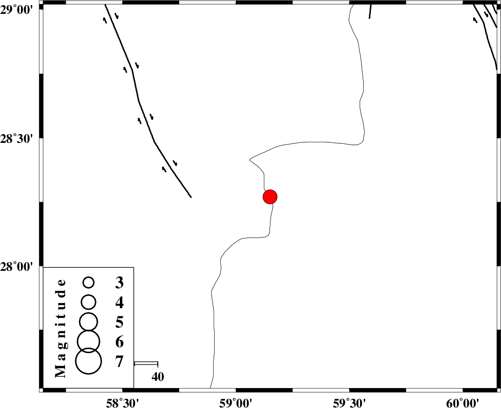
| Location | Lat:28.27 Lon: 59.15 |
| Region | Sistan va Baloochestan Province, 121 km South-East of Bam |
Nearest Cities |
|
| 49 km South of Hoseynabad, Kerman Province | |
| 57 km South East of Mohammadabad-e gonbaki, Kerman Province | |
| 68 km North East of Borj-e abbasabad, Kerman Province | |
| 71 km South East of Void, Kerman Province | |
| 81 km South East of Fahroj, Kerman Province | |
| Depth | 15 km |
| Agency | |
Faults within 150 km: |
|
| BAM_F (Length: 118 km) , Distance to epicenter: 34 km | |
| KANURAK_F (Length: 135 km) , Distance to epicenter: 88 km | |
| DAMAN_F (Length: 167 km) , Distance to epicenter: 104 km | |
| Number of Phases | 4 |
| RMS | 0.5 |
| Number of Stations | 4 |
| Error in Latitude | >8.7 km |
| Error in Longitude | 6.4 km |
| Error in Depth | 0 km |
Download waveform in seisan format
to download seisan software Click here
to access information about IIEES stations Click here
Amplitude | ||||||||
| UID | Agency | Station | Component | Amplitude | Period | Arrival Time | Proccessing Time | Signal Clip |
| 77384 | IIEES | KRBR | N | 502.9 | 0.62 | 2011-01-27 09:22:01 | 2011-01-27 09:31:00 | n |
| 77385 | IIEES | KRBR | E | 411.6 | 0.58 | 2011-01-27 09:22:04 | 2011-01-27 09:31:00 | n |
| 77386 | IIEES | BNDS | E | 623.6 | 0.52 | 2011-01-27 09:21:54 | 2011-01-27 09:31:00 | n |
| 77387 | IIEES | BNDS | N | 560.9 | 0.5 | 2011-01-27 09:21:59 | 2011-01-27 09:31:00 | n |
Phase | ||||||||||||
| Agency | Station | Component | Phase Type | Phase Quality | First Motion | Observed Arrival Time | Time Residual | Loc. Flag | Input Weight | Distance | Azimuth | |
| IIEES | ZHSF | Z | Pn | E | 2011-01-27 09:21:06 | -0.3 | y | 217 | 47 | |||
| IIEES | KRBR | Z | Pn | E | 2011-01-27 09:21:17 | 0.6 | y | 300 | 310 | |||
| IIEES | BNDS | Z | Pn | E | 2011-01-27 09:21:17 | -0.6 | y | 309 | 252 | |||
| IIEES | CHBR | Z | Pn | E | 2011-01-27 09:21:20 | 0.4 | y | 325 | 156 | |||