
Magnitude |
:5.3 |
| Date & Time (UTC) | 2011-01-27 08:43:27.5 |
| Date & Time (Local) | 1389/11/7 12:13:27.5 |
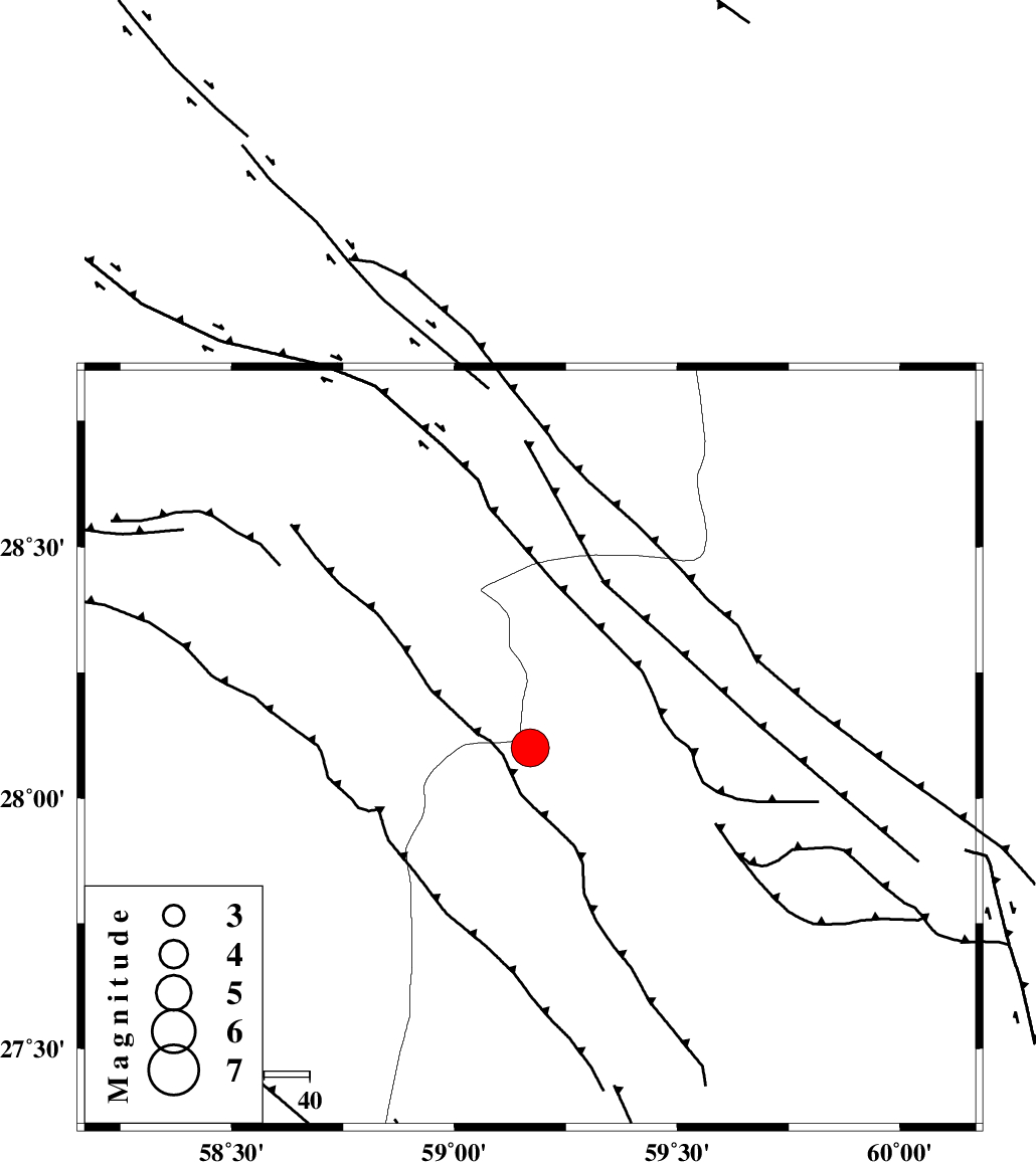
| Location | Lat:28.1 Lon: 59.17 |
| Region | Sistan va Baloochestan Province, 146 km North-East of Kahnuj |
Nearest Cities |
|
| 65 km North East of Borj-e abbasabad, Kerman Province | |
| 68 km South East of Hoseynabad, Kerman Province | |
| 74 km South East of Mohammadabad-e gonbaki, Kerman Province | |
| 76 km North West of Kalemursi, Sistan va Baloochestan Province | |
| 90 km South East of Void, Kerman Province | |
| Depth | 15 km |
| Agency | |
Faults within 150 km: |
|
| BAM_F (Length: 118 km) , Distance to epicenter: 40 km | |
| KANURAK_F (Length: 135 km) , Distance to epicenter: 104 km | |
| KASKIN_F (Length: 100 km) , Distance to epicenter: 106 km | |
| Number of Phases | 4 |
| RMS | 0.1 |
| Number of Stations | 4 |
| Error in Latitude | >2.4 km |
| Error in Longitude | 1.8 km |
| Error in Depth | 0 km |
Download waveform in seisan format
to download seisan software Click here
to access information about IIEES stations Click here
Amplitude | ||||||||
| UID | Agency | Station | Component | Amplitude | Period | Arrival Time | Proccessing Time | Signal Clip |
| 77372 | IIEES | ZHSF | N | 12554.4 | 0.54 | 2011-01-27 08:44:36 | 2011-01-27 09:03:00 | n |
| 77373 | IIEES | BNDS | E | 18730.2 | 0.51 | 2011-01-27 08:44:54 | 2011-01-27 09:03:00 | n |
| 77374 | IIEES | BNDS | N | 16090.6 | 0.49 | 2011-01-27 08:44:55 | 2011-01-27 09:03:00 | n |
| 77375 | IIEES | CHBR | N | 7852.3 | 0.73 | 2011-01-27 08:45:14 | 2011-01-27 09:03:00 | n |
| 77376 | IIEES | KRBR | E | 9131.3 | 0.42 | 2011-01-27 08:45:01 | 2011-01-27 09:03:00 | n |
| 77377 | IIEES | KRBR | N | 9880.3 | 0.84 | 2011-01-27 08:45:03 | 2011-01-27 09:03:00 | n |
Phase | ||||||||||||
| Agency | Station | Component | Phase Type | Phase Quality | First Motion | Observed Arrival Time | Time Residual | Loc. Flag | Input Weight | Distance | Azimuth | |
| IIEES | ZHSF | Z | Pn | E | 2011-01-27 08:44:03 | 0.1 | y | 229 | 43 | |||
| IIEES | BNDS | Z | Pn | E | 2011-01-27 08:44:13 | 0.1 | y | 306 | 256 | |||
| IIEES | CHBR | Z | Pn | E | 2011-01-27 08:44:13 | -0.1 | y | 307 | 155 | |||
| IIEES | KRBR | Z | Pn | E | 2011-01-27 08:44:14 | -0.1 | y | 314 | 312 | |||