
Magnitude |
:4.9 |
| Date & Time (UTC) | 2011-01-27 07:02:03.8 |
| Date & Time (Local) | 1389/11/7 10:32:03.8 |
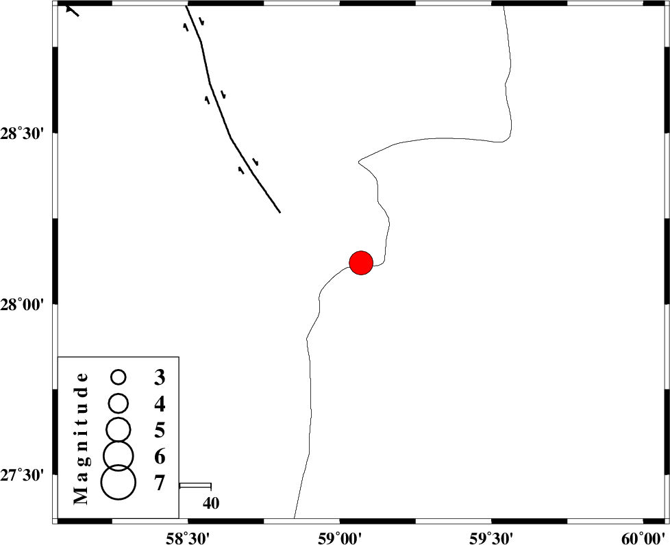
| Location | Lat:28.12 Lon: 59.07 |
| Region | Kerman Province, 137 km North-East of Kahnuj |
Nearest Cities |
|
| 55 km North East of Borj-e abbasabad, Kerman Province | |
| 65 km South of Hoseynabad, Kerman Province | |
| 69 km South East of Mohammadabad-e gonbaki, Kerman Province | |
| 82 km North West of Kalemursi, Sistan va Baloochestan Province | |
| 85 km South East of Void, Kerman Province | |
| Depth | 15 km |
| Agency | |
Faults within 150 km: |
|
| BAM_F (Length: 118 km) , Distance to epicenter: 31 km | |
| KANURAK_F (Length: 135 km) , Distance to epicenter: 107 km | |
| KASKIN_F (Length: 100 km) , Distance to epicenter: 116 km | |
| Number of Phases | 6 |
| RMS | 0.4 |
| Number of Stations | 6 |
| Error in Latitude | >5.5 km |
| Error in Longitude | 4 km |
| Error in Depth | 0 km |
Download waveform in seisan format
to download seisan software Click here
to access information about IIEES stations Click here
Amplitude | ||||||||
| UID | Agency | Station | Component | Amplitude | Period | Arrival Time | Proccessing Time | Signal Clip |
| 77356 | IIEES | ZHSF | E | 7572.5 | 0.41 | 2011-01-27 07:03:12 | 2011-01-27 07:16:00 | n |
| 77357 | IIEES | ZHSF | N | 7453.1 | 0.46 | 2011-01-27 07:03:12 | 2011-01-27 07:16:00 | n |
| 77358 | IIEES | BNDS | N | 4007.8 | 0.57 | 2011-01-27 07:03:32 | 2011-01-27 07:16:00 | n |
| 77359 | IIEES | KRBR | N | 4623.8 | 0.42 | 2011-01-27 07:03:30 | 2011-01-27 07:16:00 | n |
| 77360 | IIEES | KRBR | E | 4430.8 | 0.53 | 2011-01-27 07:03:40 | 2011-01-27 07:16:00 | n |
Phase | ||||||||||||
| Agency | Station | Component | Phase Type | Phase Quality | First Motion | Observed Arrival Time | Time Residual | Loc. Flag | Input Weight | Distance | Azimuth | |
| IIEES | ZHSF | Z | Pn | E | 2011-01-27 07:02:40 | 0.3 | y | 234 | 45 | |||
| IIEES | BNDS | Z | Pn | E | 2011-01-27 07:02:48 | 0.5 | y | 297 | 255 | |||
| IIEES | KRBR | Z | Pn | E | 2011-01-27 07:02:49 | 0 | y | 305 | 313 | |||
| IIEES | CHBR | Z | Pn | E | 2011-01-27 07:02:50 | -0.2 | y | 313 | 153 | |||
| IIEES | GHIR | Z | Pn | E | 2011-01-27 07:03:25 | -0.6 | y | 598 | 273 | |||
| IIEES | SHRT | Z | Pn | E | 2011-01-27 07:03:28 | -0.5 | y | 623 | 10 | |||