
Magnitude |
:3.5 |
| Date & Time (UTC) | 2011-01-16 23:38:28.7 |
| Date & Time (Local) | 1389/10/27 03:08:28.7 |
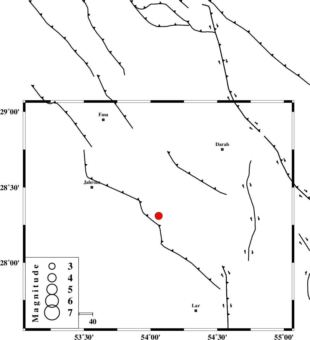
| Location | Lat:28.31 Lon: 54.06 |
| Region | Fars Province, 53 km South-East of Jahrom |
Nearest Cities |
|
| 17 km West of Dabiran, Fars Province | |
| 23 km North East of Juyam, Fars Province | |
| 28 km West of Shahr-e pir, Fars Province | |
| 36 km West of Hajiabad, Fars Province | |
| 37 km South East of Khorramabad, Fars Province | |
| Depth | 17 km |
| Agency | |
Faults within 150 km: |
|
| BERIZ_F (Length: 49 km) , Distance to epicenter: 46 km | |
| HZF2 (Length: 437 km) , Distance to epicenter: 54 km | |
| BAKHTEGAN_F (Length: 94 km) , Distance to epicenter: 55 km | |
| Number of Phases | 6 |
| RMS | 0.1 |
| Number of Stations | 5 |
| Error in Latitude | >3.5 km |
| Error in Longitude | 1.9 km |
| Error in Depth | 6 km |
Download waveform in seisan format
to download seisan software Click here
to access information about IIEES stations Click here
Amplitude | ||||||||
| UID | Agency | Station | Component | Amplitude | Period | Arrival Time | Proccessing Time | Signal Clip |
| 77187 | IIEES | GHIR | E | 1124.5 | 0.32 | 2011-01-16 23:39:06 | 2011-01-16 11:52:00 | n |
| 77188 | IIEES | GHIR | N | 1302.4 | 0.36 | 2011-01-16 23:39:18 | 2011-01-16 11:52:00 | n |
| 77189 | IIEES | BNDS | N | 303.5 | 0.28 | 2011-01-16 23:39:44 | 2011-01-16 11:52:00 | n |
| 77190 | IIEES | BNDS | E | 317.9 | 0.68 | 2011-01-16 23:39:45 | 2011-01-16 11:52:00 | n |
| 77191 | IIEES | AHRM | E | 132.5 | 0.56 | 2011-01-16 23:39:57 | 2011-01-16 11:52:00 | n |
| 77192 | IIEES | AHRM | N | 179.8 | 0.52 | 2011-01-16 23:39:59 | 2011-01-16 11:52:00 | n |
| 77193 | IIEES | KRBR | N | 252.2 | 0.52 | 2011-01-16 23:40:04 | 2011-01-16 11:52:00 | n |
Phase | ||||||||||||
| Agency | Station | Component | Phase Type | Phase Quality | First Motion | Observed Arrival Time | Time Residual | Loc. Flag | Input Weight | Distance | Azimuth | |
| IIEES | GHIR | Z | P | E | 2011-01-16 23:38:46 | -0.1 | y | 105 | 269 | |||
| IIEES | BNDS | Z | P | E | 2011-01-16 23:39:04 | -0.1 | y | 231 | 115 | |||
| IIEES | AHRM | Z | P | E | 2011-01-16 23:39:10 | 0.2 | y | 277 | 284 | |||
| IIEES | KRBR | Z | P | E | 2011-01-16 23:39:16 | 0.1 | y | 322 | 54 | |||
| IIEES | KRBR | N | Sg | E | 2011-01-16 23:39:59 | 0 | y | 322 | 54 | |||
| IIEES | NASN | Z | P | E | 2011-01-16 23:39:39 | -0.2 | y | 512 | 347 | |||