
Magnitude |
:4.5 |
| Date & Time (UTC) | 2011-01-09 18:11:04.4 |
| Date & Time (Local) | 1389/10/19 21:41:04.4 |
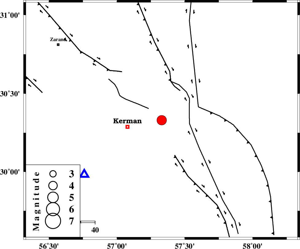
| Location | Lat:30.33 Lon: 57.33 |
| Region | Kerman Province, 25 km East of Kerman |
Nearest Cities |
|
| 19 km North East of Sarasiyab-e ferangi, Kerman Province | |
| 20 km South of Dehlulu, Kerman Province | |
| 25 km North East of Kerman, Kerman Province | |
| 27 km North West of Sirch, Kerman Province | |
| 30 km North of Mohiabad, Kerman Province | |
| Depth | 14 km |
| Agency | |
Faults within 150 km: |
|
| CHATRUD_F (Length: 37 km) , Distance to epicenter: 12 km | |
| GOLBAF_SIRCH_F (Length: 114 km) , Distance to epicenter: 20 km | |
| LAKARKUH_F (Length: 138 km) , Distance to epicenter: 25 km | |
| Number of Phases | 6 |
| RMS | 0.1 |
| Number of Stations | 5 |
| Error in Latitude | >2.7 km |
| Error in Longitude | 5.2 km |
| Error in Depth | 6.8 km |
Download waveform in seisan format
to download seisan software Click here
to access information about IIEES stations Click here
Amplitude | ||||||||
| UID | Agency | Station | Component | Amplitude | Period | Arrival Time | Proccessing Time | Signal Clip |
| 77047 | IIEES | KRBR | E | 16305 | 0.2 | 2011-01-09 18:11:25 | 2011-01-09 09:33:00 | n |
| 77048 | IIEES | KRBR | N | 23967.4 | 0.16 | 2011-01-09 18:11:26 | 2011-01-09 09:33:00 | n |
| 77049 | IIEES | BNDS | E | 1667.7 | 0.32 | 2011-01-09 18:12:42 | 2011-01-09 09:33:00 | n |
| 77050 | IIEES | BNDS | N | 2407.8 | 0.56 | 2011-01-09 18:12:42 | 2011-01-09 09:33:00 | n |
Phase | ||||||||||||
| Agency | Station | Component | Phase Type | Phase Quality | First Motion | Observed Arrival Time | Time Residual | Loc. Flag | Input Weight | Distance | Azimuth | |
| IIEES | KRBR | Z | P | E | 2011-01-09 18:11:16 | -0.1 | y | 67.4 | 235 | |||
| IIEES | BNDS | Z | P | E | 2011-01-09 18:11:55 | 0.1 | y | 344 | 200 | |||
| IIEES | TABS | Z | P | E | 2011-01-09 18:11:58 | 0.1 | y | 368 | 357 | |||
| IIEES | GHIR | Z | P | E | 2011-01-09 18:12:11 | -0.1 | y | 479 | 243 | |||
| IIEES | GHIR | N | Sg | E | 2011-01-09 18:13:18 | 0.2 | y | 479 | 243 | |||
| IIEES | NASN | Z | P | E | 2011-01-09 18:12:15 | -0.1 | y | 509 | 304 | |||