
Magnitude |
:4.1 |
| Date & Time (UTC) | 2010-12-20 16:40:23.8 |
| Date & Time (Local) | 1389/9/29 20:10:23.8 |
| Location | Lat:35.25 Lon: 59.15 |
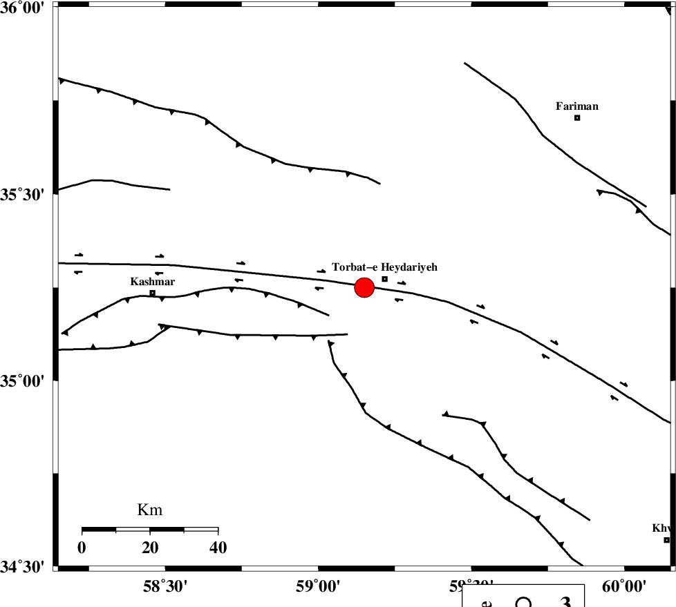
| Region | Khorasan(center) Province, 7 km Torbat-e heydariyeh |
Nearest Cities |
|
| 6 km North of Booriabad, Khorasan(center) Province | |
| 7 km of Torbat-e heydariyeh, Khorasan(center) Province | |
| 10 km of Manzar, Khorasan(center) Province | |
| 14 km North East of Shadmehr, Khorasan(center) Province | |
| 17 km South East of Babak, Khorasan(center) Province | |
| Depth | 15 km |
| Agency | |
Faults within 150 km: |
|
| DORUNEH_F (Length: 713 km) , Distance to epicenter: 12 km | |
| KASHMAR_F (Length: 91 km) , Distance to epicenter: 13 km | |
| DUGHABAD_F (Length: 62 km) , Distance to epicenter: 15 km | |
| Number of Phases | 5 |
| RMS | 0.2 |
| Number of Stations | 5 |
| Error in Latitude | >4.1 km |
| Error in Longitude | 2.6 km |
| Error in Depth | 0 km |
Download waveform in seisan format
to download seisan software Click here
to access information about IIEES stations Click here
Amplitude | ||||||||
| UID | Agency | Station | Component | Amplitude | Period | Arrival Time | Proccessing Time | Signal Clip |
| 75670 | IIEES | SHRT | N | 1536.1 | 0.52 | 2010-12-20 16:41:27 | 2010-12-20 05:04:00 | n |
| 75671 | IIEES | SHRT | E | 1798.4 | 0.32 | 2010-12-20 16:41:28 | 2010-12-20 05:04:00 | n |
| 75672 | IIEES | TABS | N | 945.9 | 0.52 | 2010-12-20 16:41:47 | 2010-12-20 05:04:00 | n |
| 75673 | IIEES | KRBR | N | 59.1 | 0.56 | 2010-12-20 16:43:33 | 2010-12-20 05:04:00 | n |
| 75674 | IIEES | KRBR | E | 77.3 | 0.52 | 2010-12-20 16:43:35 | 2010-12-20 05:04:00 | n |
Phase | ||||||||||||
| Agency | Station | Component | Phase Type | Phase Quality | First Motion | Observed Arrival Time | Time Residual | Loc. Flag | Input Weight | Distance | Azimuth | |
| IIEES | SHRT | Z | Pn | E | 2010-12-20 16:40:57 | 0 | y | 206 | 149 | |||
| IIEES | TABS | Z | Pn | E | 2010-12-20 16:41:03 | -0.2 | y | 257 | 227 | |||
| IIEES | SHRO | E | Pn | E | 2010-12-20 16:41:08 | 0.2 | y | 296 | 287 | |||
| IIEES | MRVT | Z | Pn | E | 2010-12-20 16:41:18 | -0.2 | y | 383 | 315 | |||
| IIEES | KRBR | Z | Pn | E | 2010-12-20 16:41:49 | 0.2 | y | 625 | 202 | |||