
Magnitude |
:2.9 |
| Date & Time (UTC) | 2010-11-09 16:51:27.1 |
| Date & Time (Local) | 1389/8/18 20:21:27.1 |
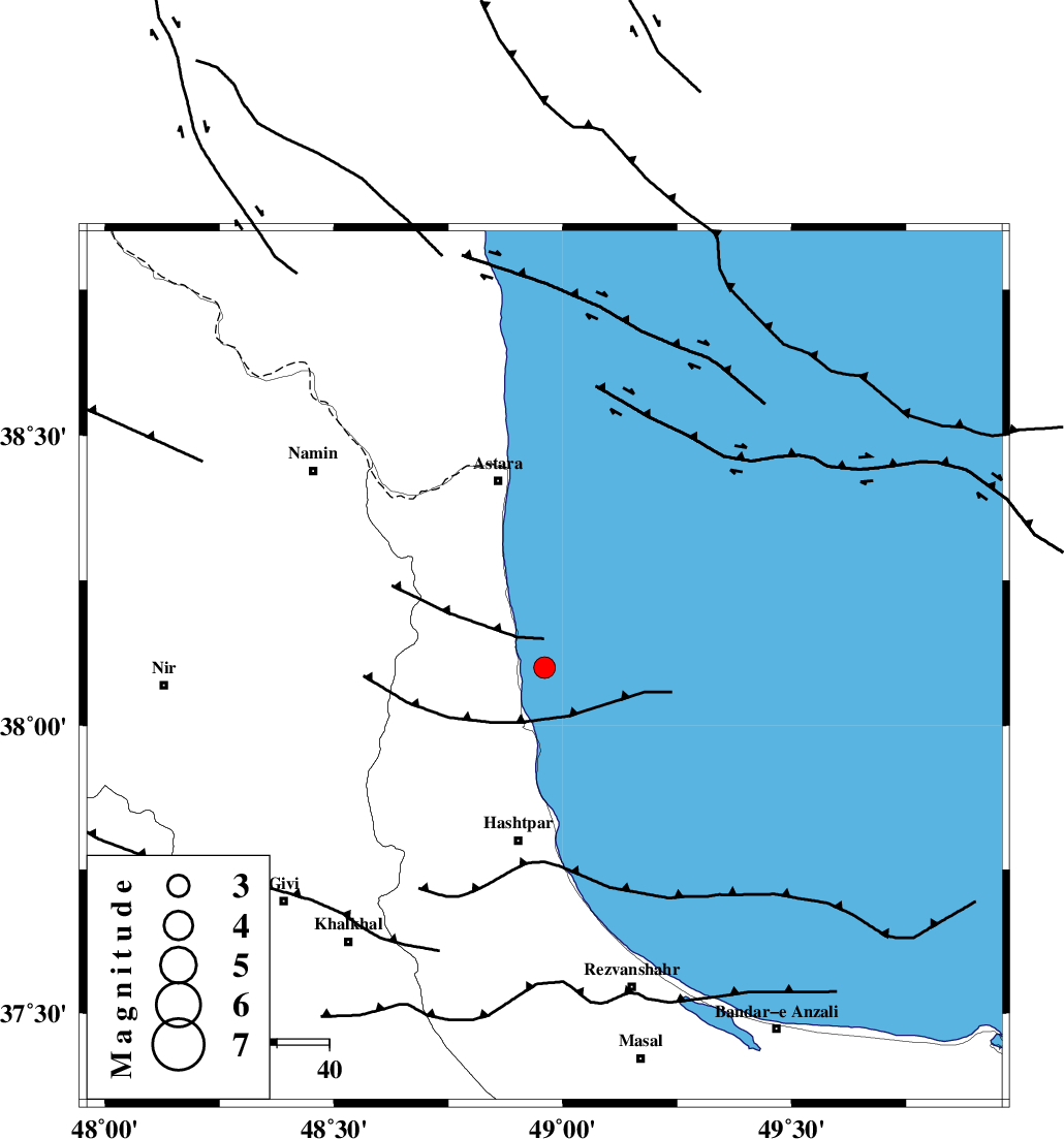
| Location | Lat:38.1 Lon: 48.96 |
| Region | Caspian Sea, 33 km North of Hashtpar |
Nearest Cities |
|
| 10 km of Hariq, Gilan Province | |
| 14 km North of Lisar, Gilan Province | |
| 25 km South East of Londovil, Gilan Province | |
| 28 km North of Chelonasr, Gilan Province | |
| 34 km North East of Kish dini, Gilan Province | |
| Depth | 14 km |
| Agency | |
Faults within 150 km: |
|
| TALESH_F (Length: 258 km) , Distance to epicenter: 19 km | |
| SANGAVAR_F (Length: 61 km) , Distance to epicenter: 38 km | |
| BOZQUSH (Length: 70 km) , Distance to epicenter: 67 km | |
| Number of Phases | 5 |
| RMS | 0 |
| Number of Stations | 3 |
| Error in Latitude | >2.1 km |
| Error in Longitude | 6.7 km |
| Error in Depth | 4 km |
Download waveform in seisan format
to download seisan software Click here
to access information about IIEES stations Click here
Amplitude | ||||||||
| UID | Agency | Station | Component | Amplitude | Period | Arrival Time | Proccessing Time | Signal Clip |
| 73110 | IIEES | GRMI | N | 253.5 | 0.16 | 2010-11-09 16:52:04 | 2010-11-09 06:09:00 | n |
| 73111 | IIEES | GRMI | E | 258.9 | 0.12 | 2010-11-09 16:52:04 | 2010-11-09 06:09:00 | n |
Phase | ||||||||||||
| Agency | Station | Component | Phase Type | Phase Quality | First Motion | Observed Arrival Time | Time Residual | Loc. Flag | Input Weight | Distance | Azimuth | |
| IIEES | GRMI | Z | Pg | E | 2010-11-09 16:51:47 | 0 | y | 122 | 311 | |||
| IIEES | GRMI | N | Sg | E | 2010-11-09 16:52:02 | 0 | y | 122 | 311 | |||
| IIEES | ZNJK | Z | Pg | E | 2010-11-09 16:51:53 | 0 | y | 160 | 189 | |||
| IIEES | ZNJK | E | Sg | E | 2010-11-09 16:52:13 | 0 | y | 160 | 189 | |||
| IIEES | SNGE | Z | Pn | E | 2010-11-09 16:52:20 | 0 | y | 363 | 204 | |||