
Magnitude |
:2.9 |
| Date & Time (UTC) | 2010-11-06 04:35:08.8 |
| Date & Time (Local) | 1389/8/15 08:05:08.8 |
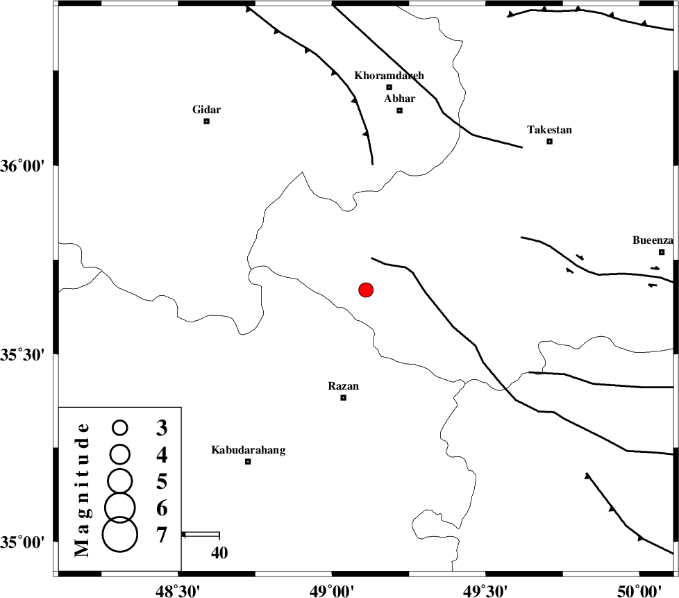
| Location | Lat:35.67 Lon: 49.11 |
| Region | Ghazvin Province, 33 km North of Razan |
Nearest Cities |
|
| 15 km North West of Avaj, Ghazvin Province | |
| 19 km West of Ab-e garm, Ghazvin Province | |
| 32 km South West of Hoseynabad, Ghazvin Province | |
| 32 km North of Razan, Hamedan Province | |
| 33 km North West of Kolanjin, Ghazvin Province | |
| Depth | 14 km |
| Agency | |
Faults within 150 km: |
|
| KUSHK_E_NOSRAT_F (Length: 230 km) , Distance to epicenter: 10 km | |
| SOLTANIYEH_F (Length: 119 km) , Distance to epicenter: 37 km | |
| IPAK_F (Length: 80 km) , Distance to epicenter: 48 km | |
| Number of Phases | 6 |
| RMS | 0.2 |
| Number of Stations | 5 |
| Error in Latitude | >2.9 km |
| Error in Longitude | 5.2 km |
| Error in Depth | 6.5 km |
Download waveform in seisan format
to download seisan software Click here
to access information about IIEES stations Click here
Amplitude | ||||||||
| UID | Agency | Station | Component | Amplitude | Period | Arrival Time | Proccessing Time | Signal Clip |
| 72975 | IIEES | CHTH | N | 111.9 | 0.56 | 2010-11-06 04:36:11 | 2010-11-06 04:52:00 | n |
| 72976 | IIEES | KHMZ | N | 83.6 | 0.47 | 2010-11-06 04:36:17 | 2010-11-06 04:52:00 | n |
| 72977 | IIEES | KHMZ | E | 101.9 | 0.39 | 2010-11-06 04:36:18 | 2010-11-06 04:52:00 | n |
| 72978 | IIEES | DAMV | N | 70.9 | 0.47 | 2010-11-06 04:36:25 | 2010-11-06 04:52:00 | n |
| 72979 | IIEES | DAMV | E | 61.4 | 0.55 | 2010-11-06 04:36:34 | 2010-11-06 04:52:00 | n |
Phase | ||||||||||||
| Agency | Station | Component | Phase Type | Phase Quality | First Motion | Observed Arrival Time | Time Residual | Loc. Flag | Input Weight | Distance | Azimuth | |
| IIEES | ZNJK | Z | Pg | E | 2010-11-06 04:35:28 | -0.1 | y | 117 | 341 | |||
| IIEES | ZNJK | E | Sg | E | 2010-11-06 04:35:43 | 0 | y | 117 | 341 | |||
| IIEES | ASAO | Z | Pg | E | 2010-11-06 04:35:33 | -0.2 | y | 150 | 146 | |||
| IIEES | CHTH | Z | Pg | E | 2010-11-06 04:35:39 | -0.2 | y | 184 | 81 | |||
| IIEES | KHMZ | Z | Pn | E | 2010-11-06 04:35:45 | 0.1 | y | 228 | 160 | |||
| IIEES | DAMV | Z | Pn | E | 2010-11-06 04:35:49 | 0.3 | y | 259 | 90 | |||