
Magnitude |
:4 |
| Date & Time (UTC) | 2010-10-23 17:19:48.9 |
| Date & Time (Local) | 1389/8/1 20:49:48.9 |
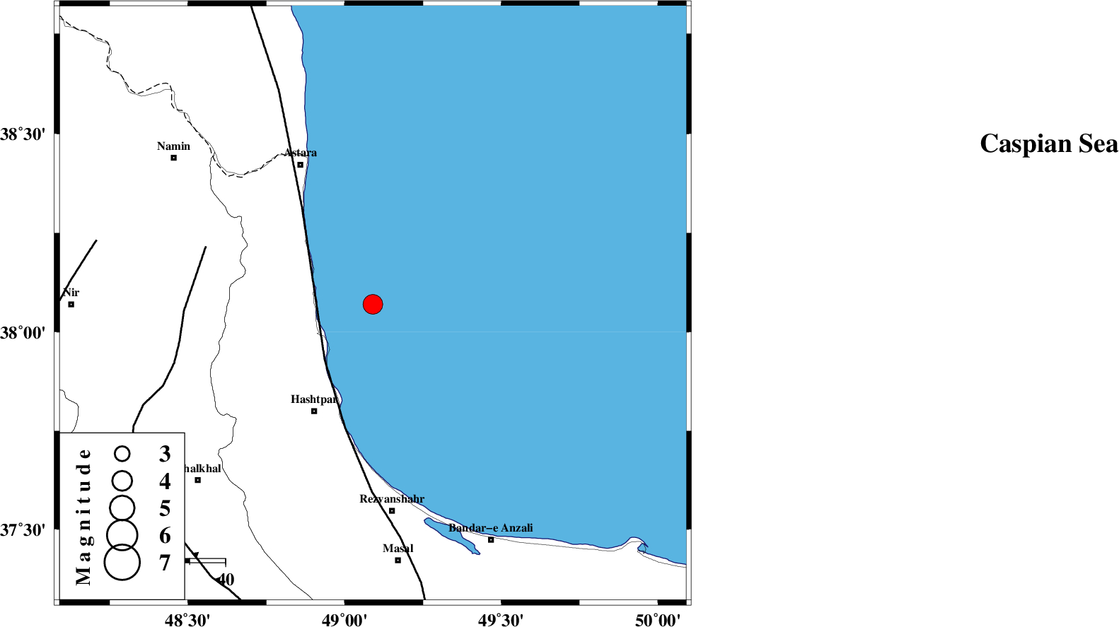
| Location | Lat:38.07 Lon: 49.09 |
| Region | Caspian Sea, 34 km North-East of Hashtpar |
Nearest Cities |
|
| 17 km North East of Lisar, Gilan Province | |
| 21 km East of Hariq, Gilan Province | |
| 28 km North East of Chelonasr, Gilan Province | |
| 34 km South East of Londovil, Gilan Province | |
| 34 km North East of Hashtpar, Gilan Province | |
| Depth | 15 km |
| Agency | |
Faults within 150 km: |
|
| TALESH_F (Length: 258 km) , Distance to epicenter: 21 km | |
| SANGAVAR_F (Length: 61 km) , Distance to epicenter: 49 km | |
| BOZQUSH (Length: 70 km) , Distance to epicenter: 79 km | |
| Number of Phases | 5 |
| RMS | 0.4 |
| Number of Stations | 5 |
| Error in Latitude | >23 km |
| Error in Longitude | 18.5 km |
| Error in Depth | 15.5 km |
Download waveform in seisan format
to download seisan software Click here
to access information about IIEES stations Click here
Amplitude | ||||||||
| UID | Agency | Station | Component | Amplitude | Period | Arrival Time | Proccessing Time | Signal Clip |
| 72290 | IIEES | ZNJK | E | 1517.9 | 0.19 | 2010-10-23 17:20:35 | 2010-10-23 05:41:00 | n |
| 72291 | IIEES | MRVT | N | 64 | 0.36 | 2010-10-23 17:22:17 | 2010-10-23 05:41:00 | n |
| 72292 | IIEES | MRVT | E | 92.9 | 0.46 | 2010-10-23 17:22:17 | 2010-10-23 05:41:00 | n |
Phase | ||||||||||||
| Agency | Station | Component | Phase Type | Phase Quality | First Motion | Observed Arrival Time | Time Residual | Loc. Flag | Input Weight | Distance | Azimuth | |
| IIEES | ZNJK | Z | Pg | E | 2010-10-23 17:20:14 | -0.5 | y | 160 | 193 | |||
| IIEES | CHTH | Z | Pn | E | 2010-10-23 17:20:34 | 0.3 | y | 301 | 142 | |||
| IIEES | SNGE | Z | Pn | E | 2010-10-23 17:20:42 | 0.4 | y | 366 | 206 | |||
| IIEES | KHMZ | Z | Pn | E | 2010-10-23 17:20:57 | 0.3 | y | 487 | 170 | |||
| IIEES | MRVT | Z | Pn | E | 2010-10-23 17:21:12 | -0.5 | y | 618 | 92 | |||