
Magnitude |
:4.4 |
| Date & Time (UTC) | 2010-10-22 09:08:26.4 |
| Date & Time (Local) | 1389/7/30 12:38:26.4 |
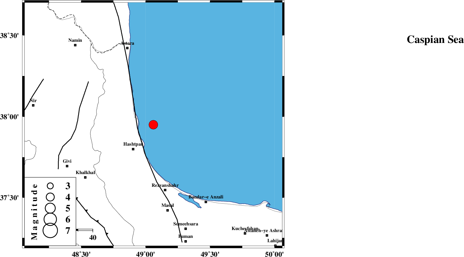
| Location | Lat:37.95 Lon: 49.06 |
| Region | Caspian Sea, 22 km North-East of Hashtpar |
Nearest Cities |
|
| 12 km East of Lisar, Gilan Province | |
| 17 km North East of Chelonasr, Gilan Province | |
| 21 km North East of Hashtpar, Gilan Province | |
| 22 km North East of Hashtpar, Gilan Province | |
| 25 km North East of Tularud, Gilan Province | |
| Depth | 15 km |
| Agency | |
Faults within 150 km: |
|
| TALESH_F (Length: 258 km) , Distance to epicenter: 11 km | |
| SANGAVAR_F (Length: 61 km) , Distance to epicenter: 51 km | |
| MASULEL_F (Length: 90 km) , Distance to epicenter: 69 km | |
| Number of Phases | 5 |
| RMS | 0.2 |
| Number of Stations | 6 |
| Error in Latitude | >7.9 km |
| Error in Longitude | 9.1 km |
| Error in Depth | 9.3 km |
Download waveform in seisan format
to download seisan software Click here
to access information about IIEES stations Click here
Amplitude | ||||||||
| UID | Agency | Station | Component | Amplitude | Period | Arrival Time | Proccessing Time | Signal Clip |
| 72230 | IIEES | ZNJK | E | 7041.2 | 0.19 | 2010-10-22 09:09:10 | 2010-10-22 09:22:00 | n |
| 72231 | IIEES | SNGE | E | 917.2 | 0.39 | 2010-10-22 09:10:07 | 2010-10-22 09:22:00 | n |
| 72232 | IIEES | MAKU | N | 336.6 | 1.24 | 2010-10-22 09:10:23 | 2010-10-22 09:22:00 | n |
| 72233 | IIEES | MRVT | E | 263.7 | 0.82 | 2010-10-22 09:10:51 | 2010-10-22 09:22:00 | n |
| 72234 | IIEES | MRVT | N | 254.5 | 0.18 | 2010-10-22 09:10:52 | 2010-10-22 09:22:00 | n |
Phase | ||||||||||||
| Agency | Station | Component | Phase Type | Phase Quality | First Motion | Observed Arrival Time | Time Residual | Loc. Flag | Input Weight | Distance | Azimuth | |
| IIEES | ZNJK | Z | Pg | E | 2010-10-22 09:08:50 | -0.2 | y | 146 | 193 | |||
| IIEES | CHTH | Z | Pn | E | 2010-10-22 09:09:10 | 0 | y | 292 | 140 | |||
| IIEES | SNGE | Z | Pn | E | 2010-10-22 09:09:18 | 0.4 | y | 352 | 206 | |||
| IIEES | MAKU | Z | Pn | E | 2010-10-22 09:09:25 | -0.1 | y | 412 | 294 | |||
| IIEES | KHMZ | Z | Pn | E | 2010-10-22 09:09:33 | 0 | y | 474 | 170 | |||